The obvious answer is yes, Detroit neighborhoods have been mapped many, many times by many different people, groups, and entities. Some Detroit neighborhoods are best understood as historic districts, others are born of strong neighborhood associations (for better, for worse), some are simply terms given to a geographic area, and others are strictly defined by non-profits and investing organizations.
“I vote that the people who live there get to decide and history must be referenced.”
Alex B. Hill, DETROITography, 2013
Historic neighborhood areas have had staying power. Most notably Corktown, although it has gone through significant changes over the years, remains the oldest neighborhood, oldest neighborhood name in continuous use in Detroit. One of the most influential programs that defined much of the city’s neighborhood was the United Community Services, what became the United Way, “subcommunities” that were drawn after each Census as a way to subdivide and track change over time in the city. Through the 1960s and 1970s those defined areas were referred to as Detroit’s neighborhoods, but with population loss many of those neighborhood names were forgotten or at least much less recognizable. The former subcommunitites were adopted as Detroit’s official master plan neighborhoods.
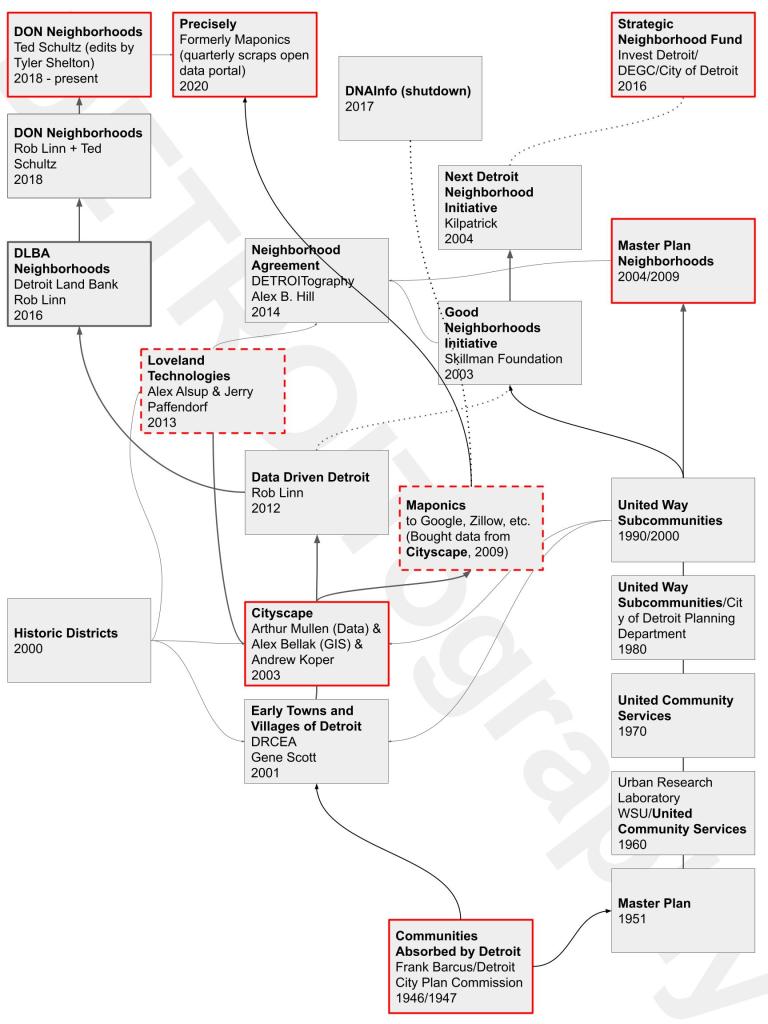
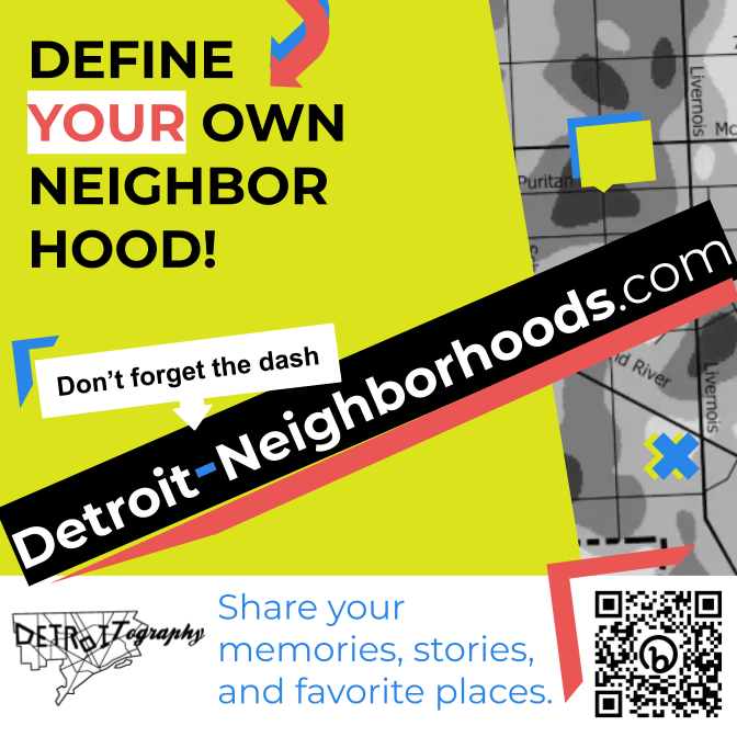
There is a genealogy to Detroit’s neighborhood maps and naming choices. Often times, the line drawing and naming have not involved Detroiters let alone the very people who reside in a geographic area because naming and claiming space can be very political or have broader economic or real estate aims that are not concerned with resident perspectives. That is the very reason that we launched Detroit-Neighborhoods.com
Countless “paper neighborhoods” have proliferated in Detroit. I questioned all of the “neighborhood” map products available in 2013 and others had similar concerns about places called “The Eye” or “Fishkorn” and the, at the time, “Corktown Shores.” Presently, the neighborhood name that is most confusing is “Buffalo” near the recently named Banglatown neighborhood at the Hamtramck border, that was quietly renamed “Buffalo-Charles” for the street intersection. Yet, no residents of the area have ever use or have heard of the name. Even the Planning Department’s outreach for the Strategic Neighborhood Fund (SNF) Banglatown framework never listed either Buffalo or Buffalo-Charles. Since the City’s Department of Neighborhoods (DON) has defined the name, it has entered the media discourse – including a handful of recent mentions in 2023.
Neighborhood naming by City government has larger implications too. All of the incorrect names or made up boundaries that the City DON has adopted get added to the open data portal, which is then downloaded – not by Google – but by a group called Precisely, formerly Maponics, that has made its business to map every neighborhood in the world. Precisely and Maponics were the preferred data providers for real estate companies like Realtor.com, Zillow, etc. that wanted to optimize searching for a new home, but were quickly contracted by any new digital company offering a map and search function. The neighborhood names many people were mad about on Google Maps came from Precisely/Maponics not Google itself.
Detroit neighborhoods can be mapped, but I’d like to see every resident have the opportunity to provide input.

I’d like to see Islandview renamed to “Islandview Village” I.e. Indian Village, West Village…..
Pingback: Loveland’s Detroit Neighborhoods Map | DETROITography