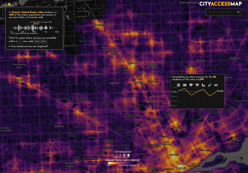
This map is based on the “15 minute” city where residents can get to services within a 15 minute walk. In Detroit this was briefly described as 20 minute neighborhoods, but a great deal of internal city administration debate eventually ended the terminology and concept.
As one would expect, Detroit lacks many “services” in its neighborhoods so scores are low outside of Greater Downtown, New Center, and a few pockets around Indian Village and Southwest Detroit. Services, based on OpenStreetMap, explored for this map project included:
- Public transit stations
- Parks, stadiums, and gyms
- Libraries and community centers
- Restaurants, food trucks, and supermarkets
- Cinemas, nightclubs, theatres
- Pharmacies, clinics, hospitals
- Education facilities
