This site is usually about Detroit, but it’s impossible to disconnect understandings of Detroit from that of Highland Park (the left side of Detroit’s bow-tie).
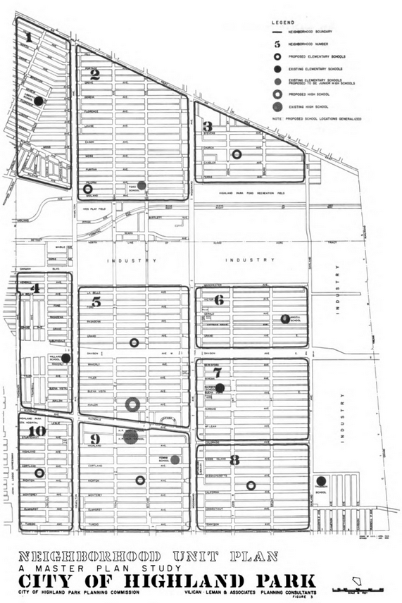
I found this map to be interesting as I’ve considered historical divisions of neighborhoods in Detroit, but had never thought about it for Highland Park. This 1958 Master Plan Study broke the city into ten neighborhood units apart from the large industrial areas.

This master plan is so interesting as I grew up in Highland Park and attended Barber School and HPHS for 9th grade in the 1960s-70s. I was surprised to read that the planners anticipated the 1980 population to remain about the same as 1958. Did they not have a sense of the de-centralizing trend of industry? I also noticed the use of the term possible “urban renewal” areas – certainly coded language. But nowhere do the planners mention racial/ethnic demographics of HP.
Thanks for posting this.