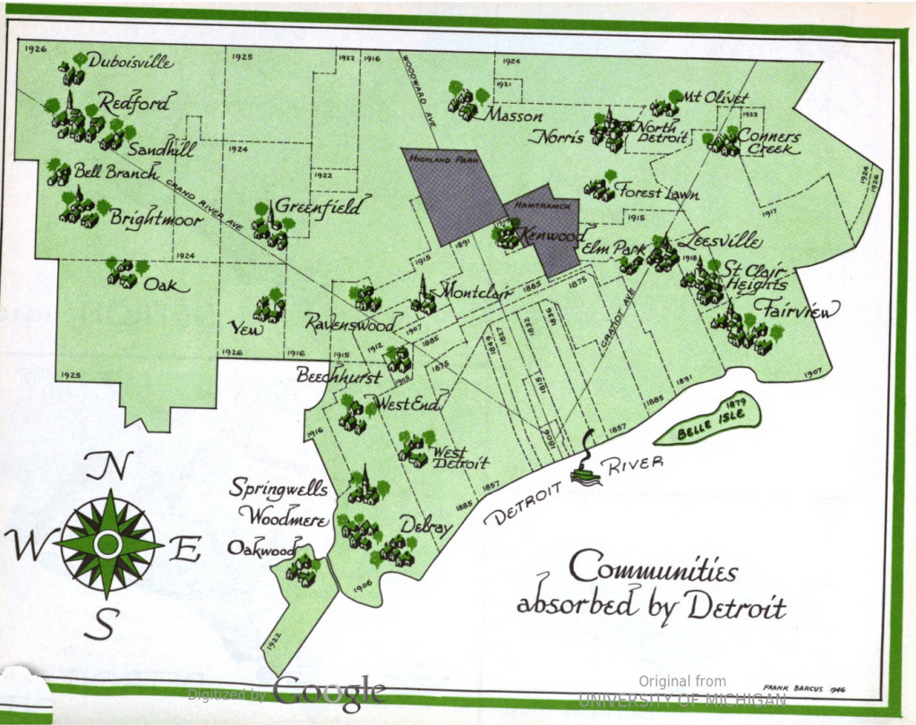
The content in this map was recreated in 2003 as a historical reference to place names in Detroit, but the original was included in the 1947 Master Plan for the City of Detroit. Many of the existing place names like St. Clair Heights, Greenfield, and Fairview are captured in street names. Others like Delray, Brightmoor, Mt. Olivet, Elm Park, and Redford live on as neighborhoods, communities, or cemeteries.
