
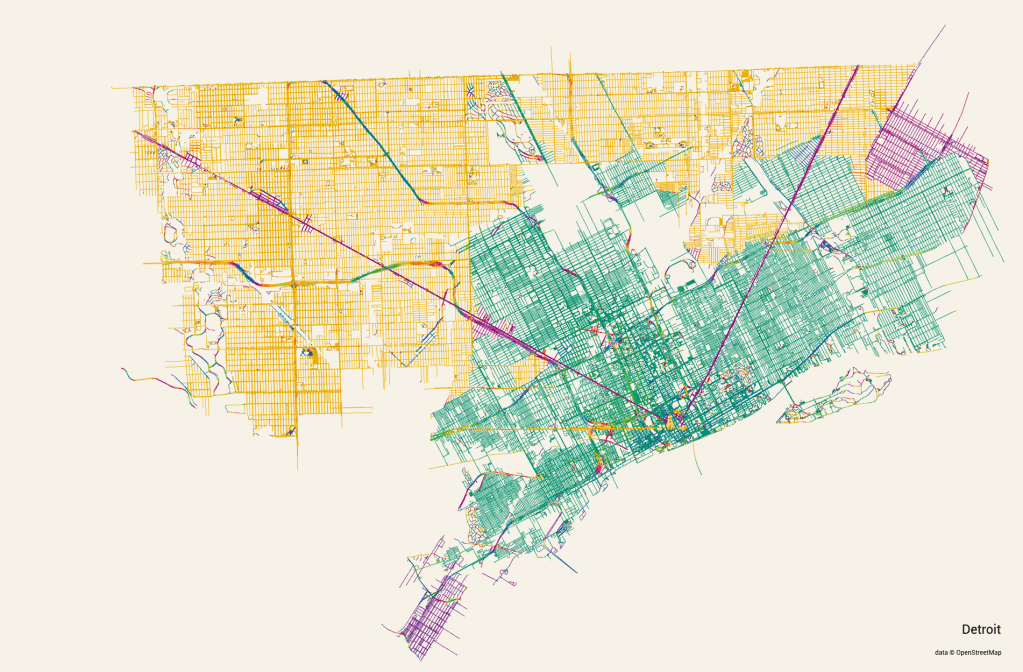
Andrei Kashcha developed an app that pulls all street data from Open Street Map and color codes it by the cardinal direction orientation of the roadway.
The resulting map presents a beautiful reminder that Detroit has a diverging urban planning history from spoke streets (based on trails of indigenous peoples?), street grid based on river access and ribbon farms, to the modern Jeffersonian grid.
