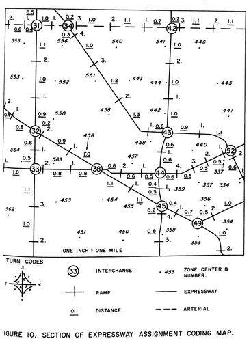
I stumbled across this hand drawn map and found it fascinating. It’s really interesting to think about the breakdown of planning an expressway from its ramps, interchanges, trip directions, construction sections, etc. If you couldn’t guess the area pictured is Northwest Detroit. I assume this coding has lived on until today, but haven’t verified yet.

Indeed, a very fascinating map. It is interesting to know whether the coding has really lived on to this day. If you know this information, I would really appreciate it if you share it here. I am very interested in cartography and history. And especially I really like to study regional features. It seems to be quite patriotic. I found your site for a long time ago, I periodically look at your new published maps and thanks to you I learn new things for myself. I am glad that there are people who love their region as much as I do. I wish you success and creative inspiration! And I look forward to new posts.