
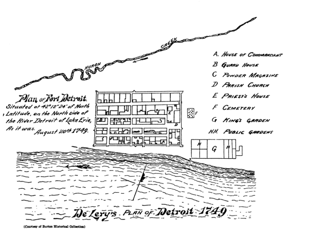
Many people have seen Bellin’s map of Fort Detroit from 1764, but fewer people know that Bellin’s map was based on Gaspard-Joseph Chaussegros de Lery’s survey in 1749. Huron Creek really stands out as a significant landmark.
This version of De Lery’s map appears in “History of Wayne County and the city of Detroit, Michigan” edited by Clarence and M. Agnes Burton.

Pingback: Map: de Lery’s Copy of de Boishebert’s Map of Detroit 1731 | DETROITography