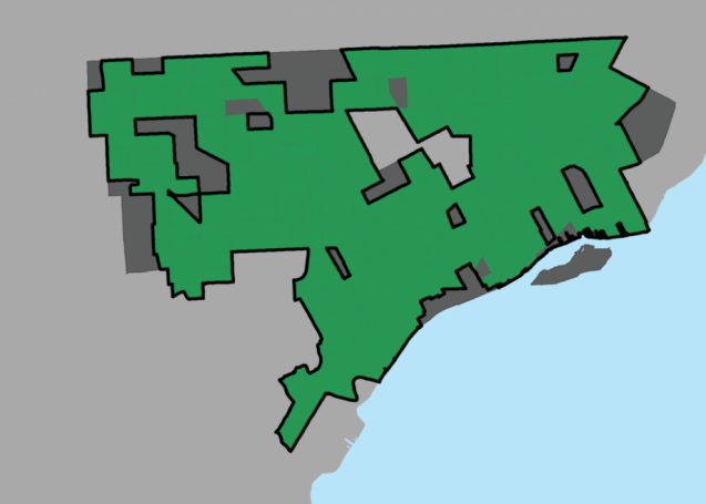
The current presidential election has renewed the regular use of veiled racism in language. In particular the use of “inner city” has often been used as a negative term for communities of color. In a recent report, the Initiative for a Competitive Inner City (ICIC) has defined nearly all of Detroit as “inner city:”
ICIC defines an inner city as a set of contiguous census tracts in a city that have higher poverty and unemployment rates than the surrounding metropolitan area and, in aggregate, represent at least five percent of a city’s population. These neighborhoods also must have a poverty rate of at least 20 percent, and unemployment rates at least 150 percent of metropolitan area unemployment (or a median household income that is 50 percent or less than median income for the metropolitan area).
Note: Windsor, Canada has also been consumed by the Detroit River.

Sent from Windows Mail