Map: Detroit Driving Time 1970

detroit-driving-map-1970

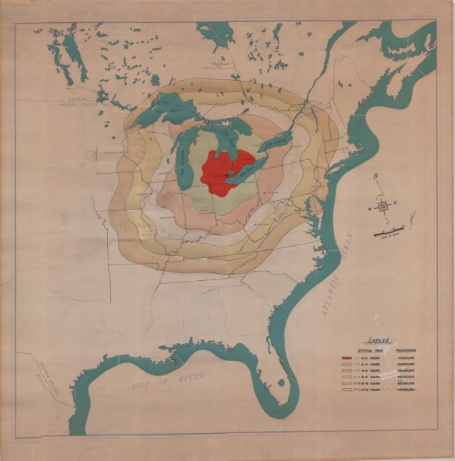
Earlier this year we shared a map of how far you could get driving on $50 of gas from Detroit. The Detroit Historical Society has a similar map from the 1970s that just looks at driving time from Detroit.

The red color shows how far you can get with 2 hours driving time.

Leave a Reply

Fill in your details below or click an icon to log in:

WordPress.com Logo

You are commenting using your WordPress.com account. Log Out /  Change )

Facebook photo

You are commenting using your Facebook account. Log Out /  Change )

Connecting to %s