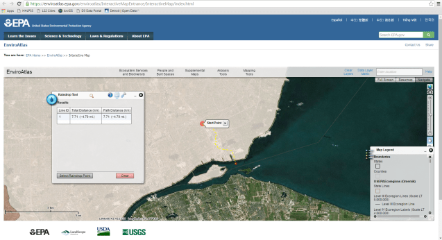
Wondering where all this rain ends up? The EPA’s Environmental Atlas provides some really interesting tools, including tracking where a raindrop ends up when it lands in Detroit. After zooming into Wayne County, Michigan, in the gray navigation bar choose “Analysis Tools” and select the “Raindrop Tool.”
This is a great way to check out sewer/drainage infrastructure and how a raindrop nearly always ends up in the Detroit River.
