 In 2010, Lars Gräbner of Volume One Studio and the University of Michigan Taubman College, began conducting a mapping study of Detroit in order to conceptualize a future for the city.
More from Lars Gräbner:
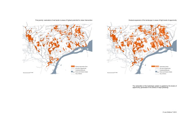
“The restoration of the hydrologic system is guided by the levels of opportunity, generated in this series of maps (phasing).
First priority: restoration of wetlands in areas of highest potential for urban intervention.
Gradual expansion of the landscape in areas of high levels of opportunity.”
These maps were featured in Mapping Detroit (Chapter 8: Mapping the Urban Landscape: Revealing the Archipelago) available from the WSU Press.
