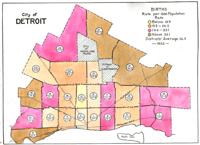
This map comes from the Detroit Department of Health’s report titled “A birdseye view of Detroit’s health status for the year 1922.” The city existed as 23 districts with “populations sufficiently large to make the comparison of rates worth while.”
The report was put together via typewriter and hand drawn maps. It even looks like the colors were painted on with watercolor.
