

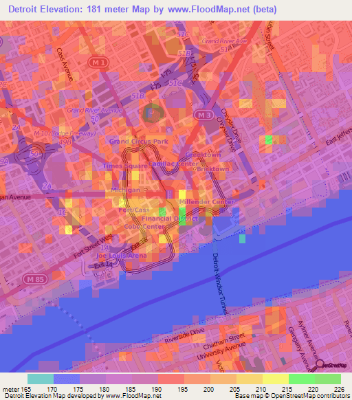
This “elevation map” of Detroit utilizes NASA’s 90m resolution SRTM data in order to assume topography. As is readily evident, the map shows building heights rather than any topography or land elevation as there is minimal change in elevation across Detroit. Although, it does look pretty.
Downtown and Lafayette Park (see below) show obvious increases in elevation based on skyscrapers.

Pingback: Map: If the Detroit River Flooded | DETROITography