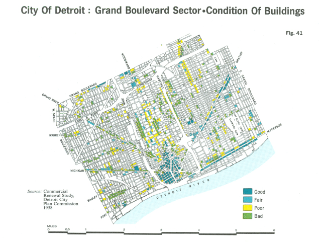
From Doxiadis’ “Emergence and Growth of an Urban Region” Volume 2 based on data from the Commercial Renewal Study by the Detroit City Planning Commission in 1958.
What is interesting about this map is that we can compare to today’s conditions as this “Grand Boulevard Sector” encompasses the current hotspots for redevelopment: Downtown, Midtown, Corktown, Eastern Market, and the East Riverfront. In 1958, we can already see from the map the pre-1960s economic and industrial decline in the city’s core with a cluster of poor conditioned buildings along Woodward in what is now Midtown.
