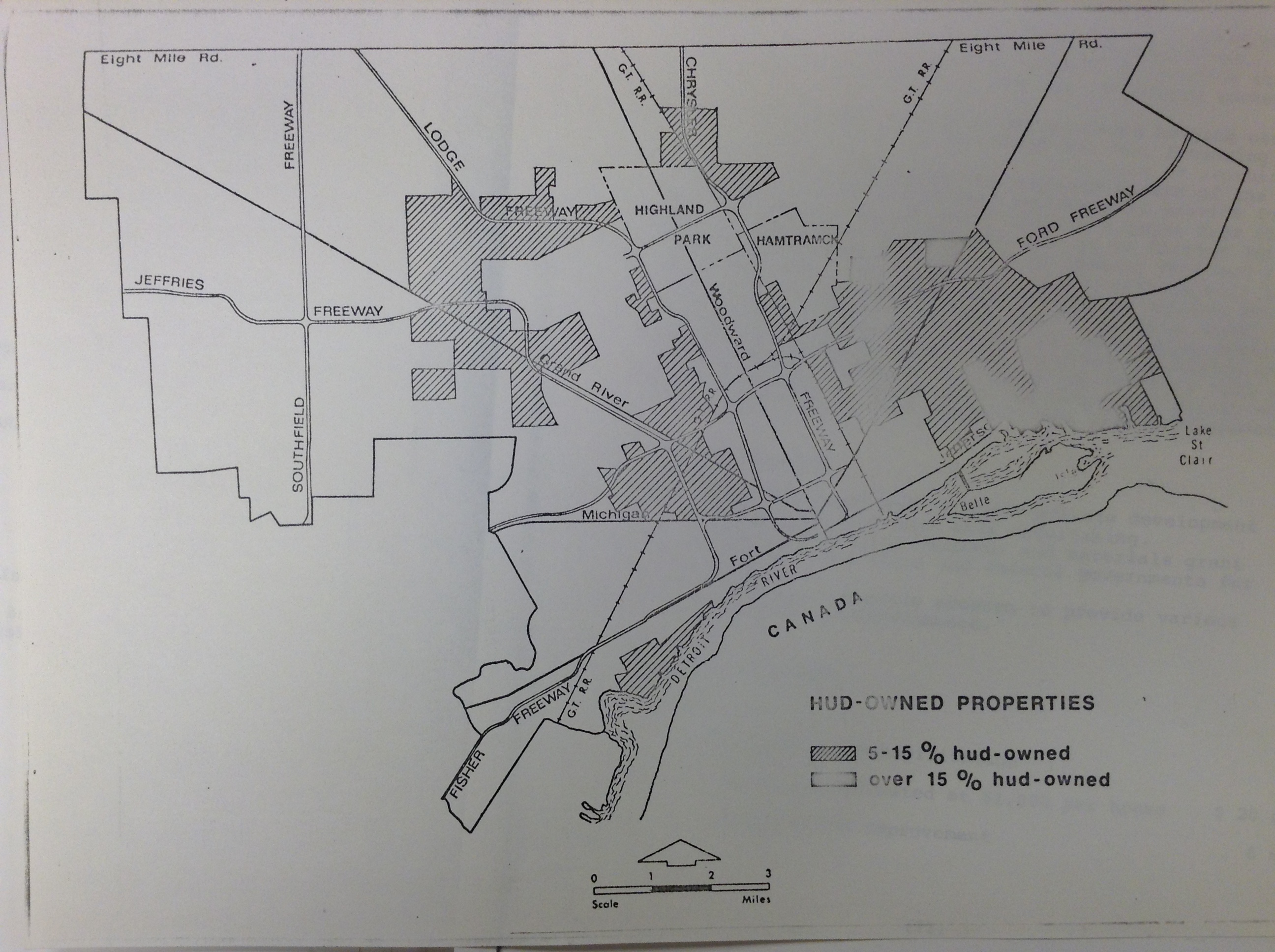
 This map comes from the William Milliken Papers in the Bentley Historical Library at the University of Michigan. The map represents all HUD owned properties in 1975. The highest concentrations (blurry areas) currently match where a lot of housing cooperatives and senior apartments now sit along the East Riverfront. There is also an interesting concentration in the Corktown (north of Michigan Ave.) area.
