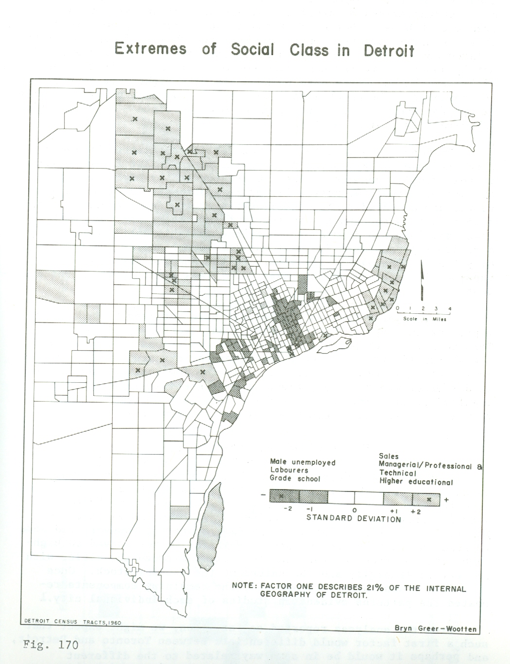
This map is published in William Bunge’s book co-authored with R. Bordessa, “The Canadian Alternative: Survival, Expeditions, and Urban Change.”
The map author, Bryn Greer-Wootten, utilized the 1960 Census (employment, education, income) to look at what Richard Florida might describe today as the geography of the “creative class.” Greer-Wootten finds that the inner city versus Suburb divide is quite stark.
