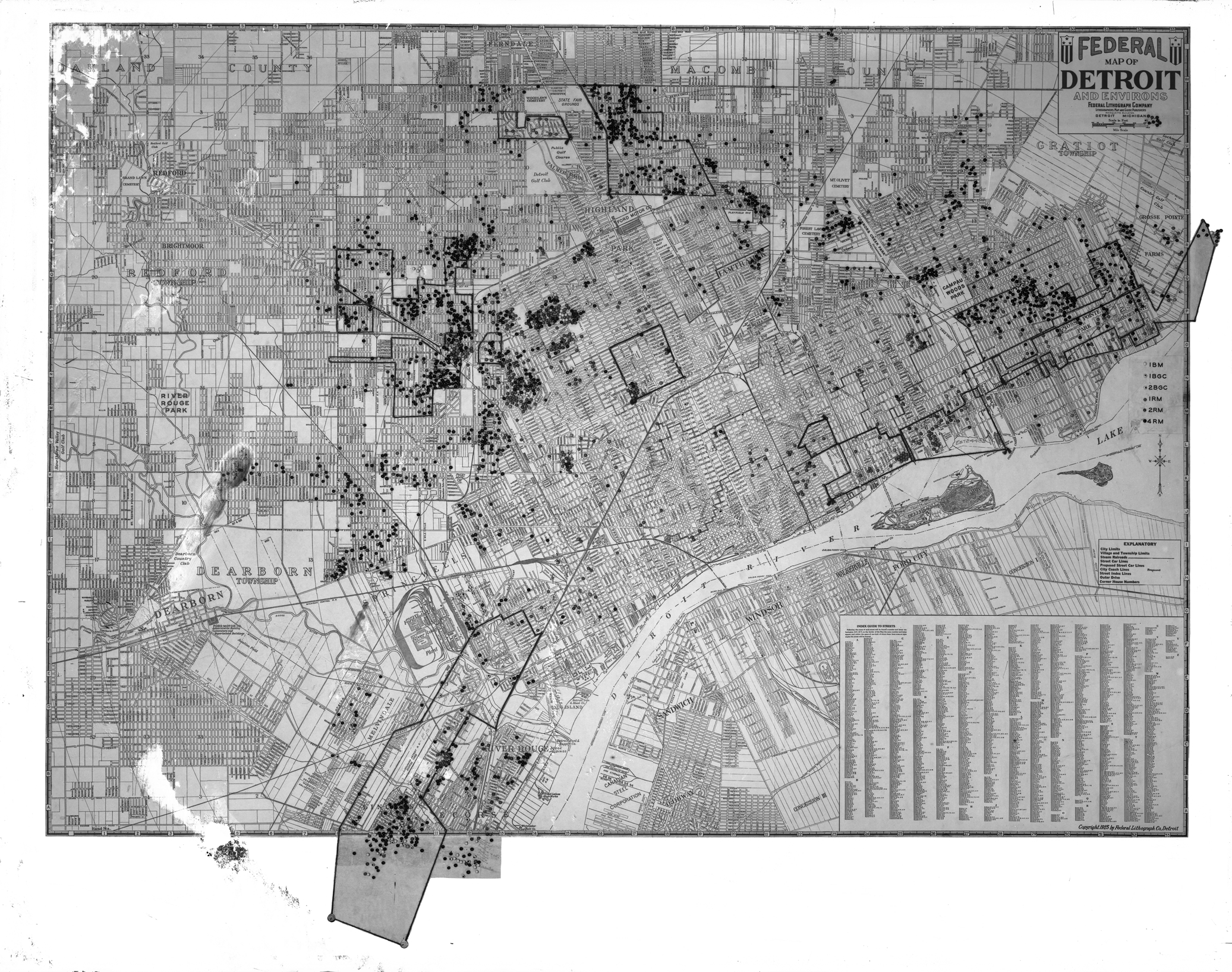
 The significance of this map is in what has been added. Certain areas have been outlined and points placed across the map. It is unclear what it all means. The added key on the right regarding the points reads:

All that is known is that it was created (year unknown) by the Federal Lithograph Company of the Marquette Building. Leave a comment if you can solve the mystery! Thanks!

Based on the lack of streets & such in the upper right corner, in Gratiot Township, this predates the maximum borders of Detroit, achieved in 1926. What the black dots are is anyone’s guess. Because I can’t blow it up to read where they are this becomes a useless exercise beyond the most basic. There are rail lines there but some of the black outlines don’t seem to have any commonality. Things like Campau Woods Park & Connors Creek Park aren’t even a memory for most Detroiters.
Possibly an ethnic map of Italian-Americans. West side group now in Livonia, Plymouth, etc. East Side group in SCS, Pointes. State Fair group in Warren, Sterling Hghts.