
by contributor: Jimmy McBroom
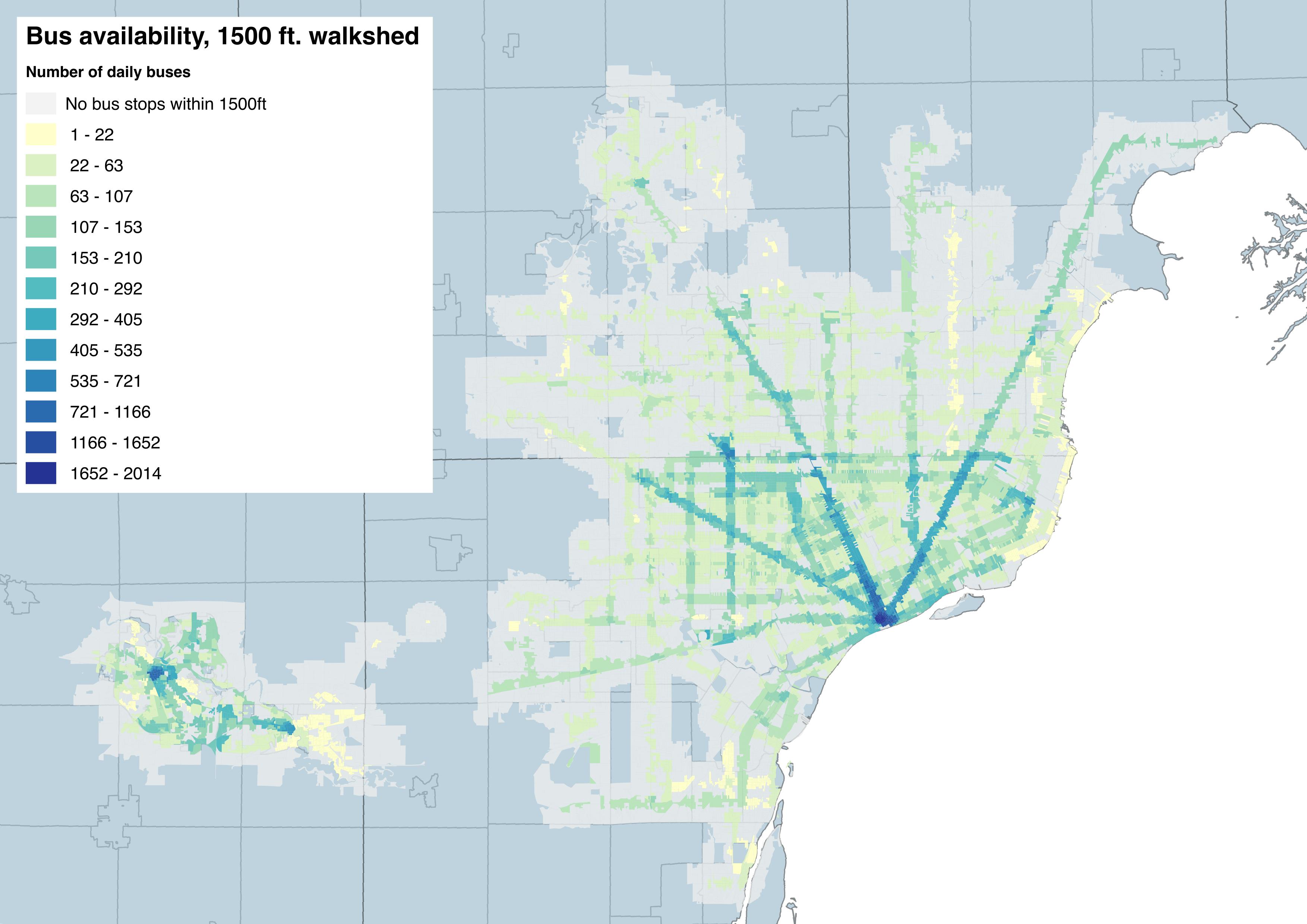
“This is a map of accessibility to the fixed-route bus system in Metro Detroit. For each block, this measure was derived by looking at the bus stops within a 1500 foot walking distance (that’s about an 8-10 minute walk). By measuring the individual routes that service those stops and the frequency of those routes, a measure of total bus trip availability was generated. For instance, since most blocks in Downtown Detroit were within a 10 minute walk of the Rosa Parks Transit Center, the number of available daily bus trips for most downtown blocks are in the 1500-2000 range. You can see similar clusters of accessibility in downtown Detroit, along the Woodward and Gratiot corridors, and near Northland Mall. Stop location & route frequency data was generated using a weekday schedule, using GTFS data from AATA, DDOT, and SMART. Census block data was derived from US Census TIGER/LINE files.”

Wondering where you were able to get the GTFS data for SMART? I have been able to get DDOT and AATA, but can’t seem to find SMART. Any suggestions would be great.
Thanks!
Chad,
Send me an email? james dot mcbroom at gmail dot com