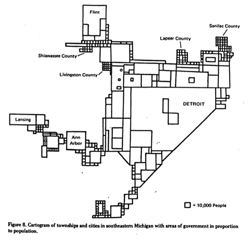
 This is a classic William Bunge map/ cartogram showing the population sizes of various southeastern Michigan municipalities reaching up to Flint and as far over as Lansing. When this was made in 1970, Detroit dominated the population charts. The city still dominates in regards to population size compared to its neighbors despite the recent population losses.

Pingback: Map: Detroit Regional Cartogram 2010 | DETROITography