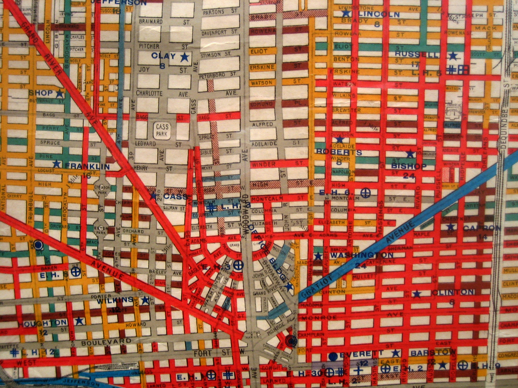
It isn’t clear what year this is from, but a very interesting map regardless. The colors represent different road surface materials. Red is brick, but the others have not been defined.
Has anyone seen this map before or know any more information?
It isn’t clear what year this is from, but a very interesting map regardless. The colors represent different road surface materials. Red is brick, but the others have not been defined.
Has anyone seen this map before or know any more information?

This looks like a more recent version of the 1896 Detroit Bicycle Map produced by the Free Press. The Hub has a snippet at http://thehubofdetroit.org/wp-content/uploads/2011/11/bikemapdetail2.jpeg
Blue is asphalt, red is brick, green is granite, Blue-gray may be Macadam, and yellow is wood. My guess is gray represents concrete. The first concrete road in Detroit was laid in 1909, so that gives some idea on how old the map may be.
I believe this is the cycling map that is on display at the Detroit Historical Museum. eg http://thehubofdetroit.org/?p=1061