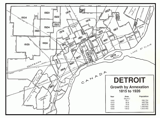
This is an excellent reference map for how the City of Detroit grew in size from Fort Detroit and the accompanying town along the river, to frontier town, to major manufacturing city.
I’m interested to see how Detroit population growth maps onto the expanding land area of the City. Not sure the historical census data will be as easy to geo-reference.
