
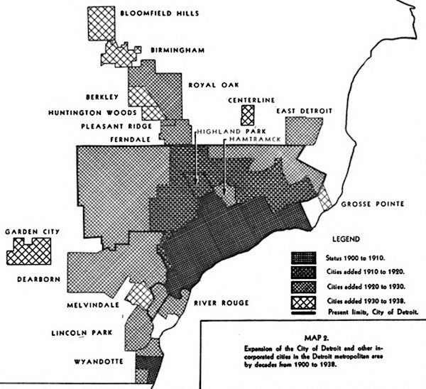
This map comes from a study titled, “A study of subdivision development in the Detroit metropolitan area” and determined that the subdivision of land outpaced population growth. The study determined that the region had an “abnormal amount of platted land” in relation to the overall population (“purely speculative”). The amount of vacant land parcels just within Detroit at the time of the study (1944) were estimated to be able to accommodate another 1 million people.
