
Rob Linn was a big inspiration for this site to become something real. His mapping topics and data deep dives have given me countless new questions and topics to pursue.
One such topic that Rob mapped in 2010 was the concept of the “last house on the prairie.” In the media hubbub of the late 2000s the concept of Detroit as a urban prairie was commonplace. Rob found the metaphor didn’t hold too well and there were just 134 “last houses on the block” (LHB). One of the LHBs that Rob noted had a recent interview in 2010 has now been demolished. Near St. Aubin and Palmer, there are now no houses on the block (NHB).
I’ve noticed a few LHBs on my drives around the city. The home across from Stanley Hong’s Mannia Cafe on East Baltimore always stood out. The other was a home on French Road just north of I-94. There is another house on Longwood, a dead end street that opens into a forest. Another home sits alone on Beniteau among the Hantz Woodlands. The Eastside has seen many streets clear out and the LHBs happen on multiple blocks of Lakeview and Eastlawn streets.
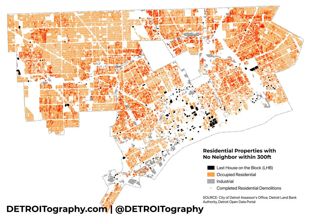
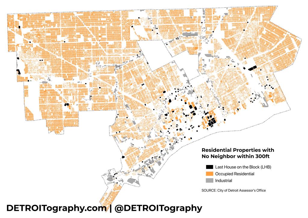
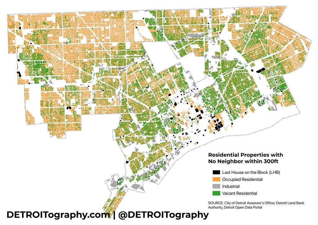
I decided to test the LHB concept in 2024 after the city has seen mass demolition of over 29,000 homes since January 1, 2014 through the Detroit Land Bank Authority (DLBA) and an influx of targeted investment in the last decade. Utilizing the City of Detroit’s parcel file from the open data portal, I selected all properties coded for residential, single family, apartment, multi-family, and their related codes. I used Rob’s same radius of 300ft and identified 155 LHBs in Detroit. In 13 instances it appears that the demolition program eliminated LHBs that had come up in my previous data analysis.
Rob’s analysis in 2010 found a very dispersed 134 LHBs with some clusters on the Near Eastside and Far Eastside. In 2024, there are more significant clusters in Greater Downtown and the Lower Eastside. It is likely that most LHBs from 2010 were eliminated through demolition and many of these 155 were also created as a result of the demolition program. Hardly an argument for a more rural city, yet vacancy remains high and much of the Eastside has seen a decades-long clearing out.

This is an innovative analysis of residential housing trends, thanks for publishing it. As a former Detroiter from the west side, have you done any analyses of that
part of town ? the urban transformation of Detroit continues, with no “smart strategy” in place to re-purpose the empty neighborhoods….. What will Detroit look like in 100 years from now !? Will it even be a city ?
Chet