
by: Angelina Tran, Wayne State University
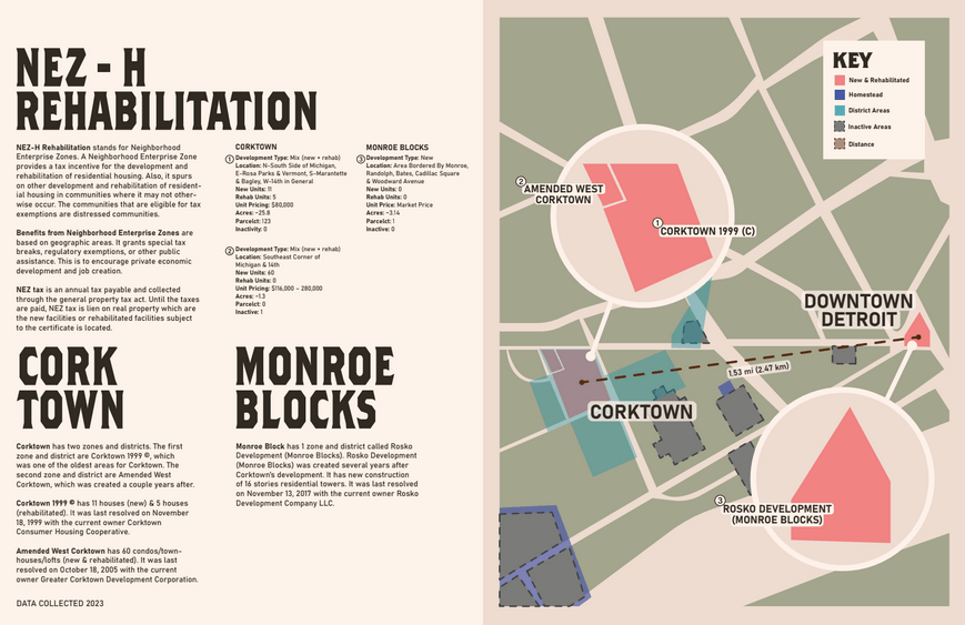
The dataset chosen was from the NEZ-H Rehabilitation and Homestead, specifically zones from Corktown and Monroe Blocks. Most younger people are not aware as to what neighborhood enterprise zones are in Michigan. This map is to educate the younger audience and anyone else who does not know what these zones are for. I compared an slightly older zone, old zone, and a zone more recent. I provided information from the City of Detroit Open Data Portal in the boundaries section of datasets. The illustrations are created by me with a help of the maps via Google. The colors are used to give a neutral setting with some pop of color depending on the importance of the map. The elements in my visual is to indicate any information provided about the tax property, borders, and more.
Dataset(s) Used: – Neighborhood Enterprise Zones – Homestead (NEZ-H), Current – NEZ NR Districts – Neighborhood Enterprise Zone (NEZ) Resolutions
This map was part of the Visualizing Detroit: The Art of Data competition and exhibit in November 2023.
