
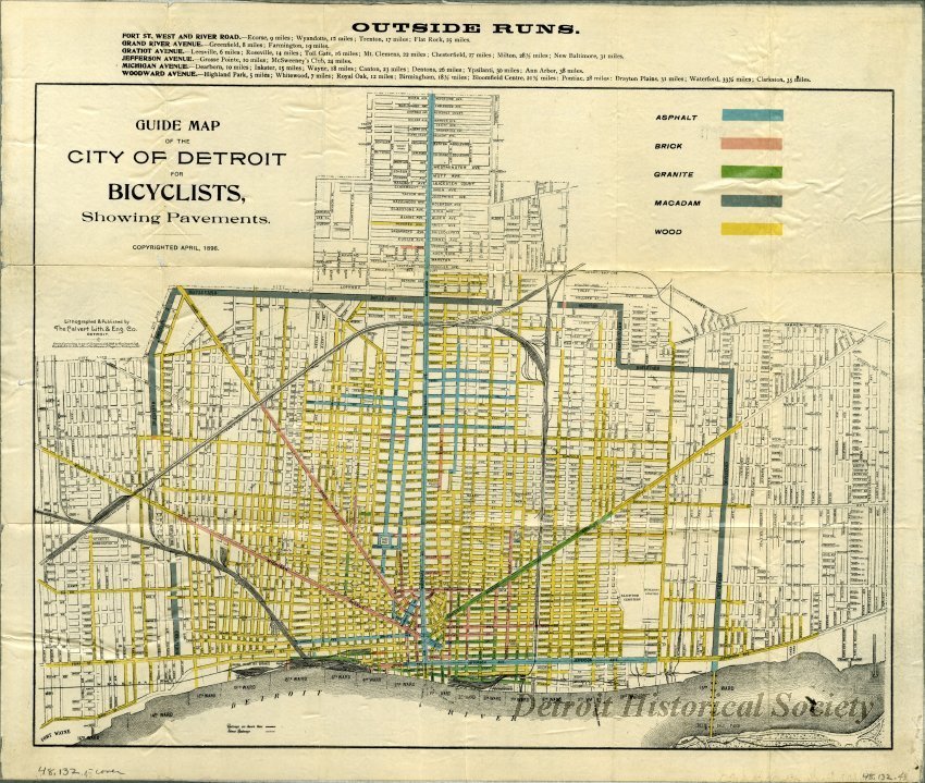
In honor of the 155th anniversary of the first bicycle ride on Detroit’s streets in 1868 I’m going to finally post this historic gem of a map that somehow I have never posted in the 10 years of cataloging Detroit maps. The map’s title points out the critical map detail: the color-coded pavement types, ranging from unpaved to wood to brick to asphalt.
Even though the League of American Wheelmen had formed over a decade earlier, this map was published in the peak of the Good Roads movement, when cities across America were responding to demands for better rights-of-way for bicyclists by paving their roadways. While most of Detroit’s streets were paved with wood, its large radial avenues and other high-traffic roads had been upgraded to granite or asphalt by 1896. Along with the numerous freight railway lines (the Dequindre Cut shows up as a railroad line that it was at the time), other streetcar lines are noted for bicyclists’ convenience.

Pingback: Maps at Home with Brittany Simmons and a Historical 1899 Bicyclist Map of Detroit | DETROITography