
If you’ve been following on Twitter, I’ve been attempting to interrogate the Mayor’s recent data points that he listed in his Mackinac Policy Conference (MPC) 2023 speech. Specifically, he noted 452 auto/scrap yards (original tweet used incorrect 454 number) with very limited information on what that category meant. The number seemed absurdly high to me as well as other city staff that regularly work with data.
https://platform.twitter.com/widgets.js#DetroitByTheNumbers for @MayorMikeDuggan
— DETROITography (@detroitography) June 2, 2023
28 (+12) hardware stores: https://t.co/YiVrIvOKkP
64 (+11) full-service grocery stores: https://t.co/GCBjypBj0U
1 (-1) movie theater: Bel-Air is the only one. Big Sean cinema coming 2024? RenCen4 is long closed
454 Scrap yards??? https://t.co/Fzbq9XoAcy
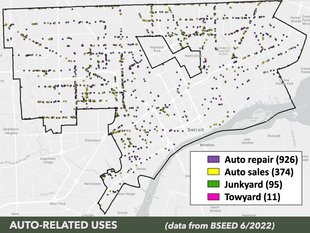
The journey took me from the Mayor’s speech to “point of interest” datasets with NAICS codes to a FOIA sent to EGLE only to have the EGLE social media team actually be most helpful. In the end the source and dataset are still mysteries, however I was able to track down the presentation given to the City Planning Commission based on BSEED data in June 2022.
The map categories list 1,406 sites, which are majority “auto repair” sites not scrap or junkyards. However, the city’s Law Department and the resolution to change the zoning notes 1,548 sites in question. I’m still waiting for access to the dataset used and learning about its sourcing. I have yet to learn if this is the same dataset used to identify hardware and grocery stores.

Pingback: Map: Conflicting Data on Auto Uses and Scrap Yards | DETROITography