What is your map from home (title, year, etc.)
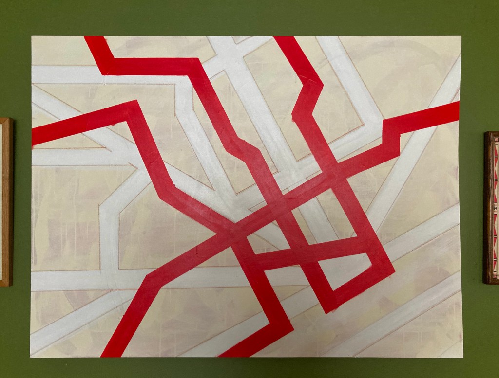
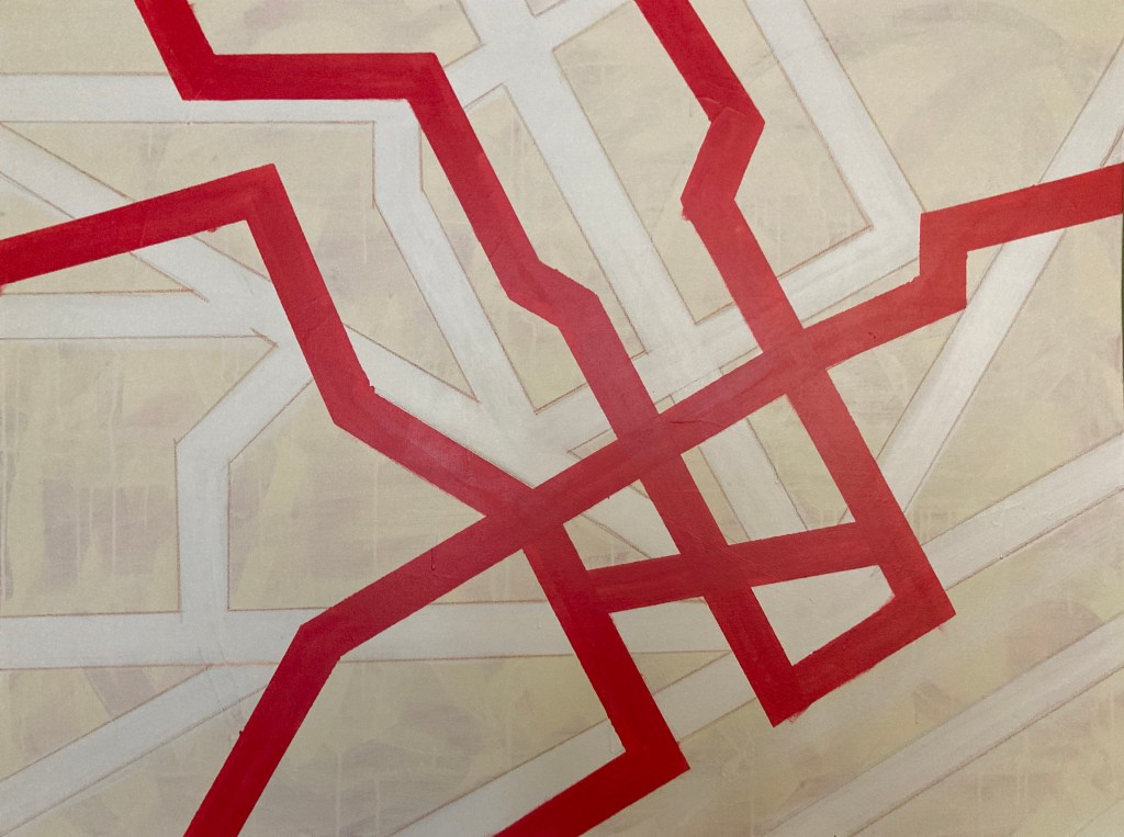
My map is an original 3ft x 4ft abstract painting that depicts major roads and highways across the greater downtown region of Detroit.
Where did you find/acquire the map?
I recently painted this map myself, using latex paint and pastels on canvas. I wanted a large, minimalist, geometric abstract piece of art to fill up a wall at home, so I decided to try and make one myself. I’m not an abstract artist, so as I thought about inspirations for a painting, I decided to utilize something I’m personally passionate about – a map of Detroit.
What made you hang it on your wall? What stood out to you? What details do you enjoy about the map?
I created the painting to hang on my wall, which influenced some of my design choices. I wanted to make a simple geometric abstract painting that could stand on its own, but also clearly resemble a map of Detroit for those familiar with the city. Rather than trying to accurately recreate a scale version of a Detroit street map, I chose to use abstract representations of some of the major surface roads, like the spoke roads, a few major mile roads and north-south thoroughfares, and some neighborhood arterials, in order to make a balanced composition of bold lines on the canvas.
I knew I also wanted a bold contrasting color on top of the muted neutral background, so I used a bright red to represent the freeways that cut through the city – the Lodge, Davison, I-75, 96, 94, and 375. The stark contrast in colors also suggests how out-of-place the urban freeways are compared to the city’s original spoke-and-grid surface roads.
What in your background has drawn you to maps?
I’ve always loved studying maps as a way to understand how cities function. I have a PhD in political science, which involved research on urban studies, such as how housing and industrial policy physically affects the people, communities, and therefore the maps of cities. Studying the history of Detroit in particular has also been a longtime passion of mine.
I also do film photography as a hobby, and I photograph historic architecture, signage, and streetscapes of different cities that I visit. I often plan driving routes for taking photos in cities by spending a lot of time on Google Maps, studying routes through neighborhoods to capture different types of architecture, businesses, and places that interest me.
I first took street photographs driving around Detroit when I was in high school in the suburbs, for a photo class. Since getting back into photography about 7 years ago, I’ve taken time to photograph Detroit a few times a year. I’ve gotten to spend a lot of time driving through different neighborhoods to get an understanding of the various roadways, buildings, businesses, housing stock, architecture, and rates of change over time throughout the city. This process of capturing photos of places throughout the city while driving and studying neighborhood maps has helped me get a better understanding of the city’s layout, the differences and uniqueness of various neighborhoods, and a greater appreciation for the history of Detroit.
