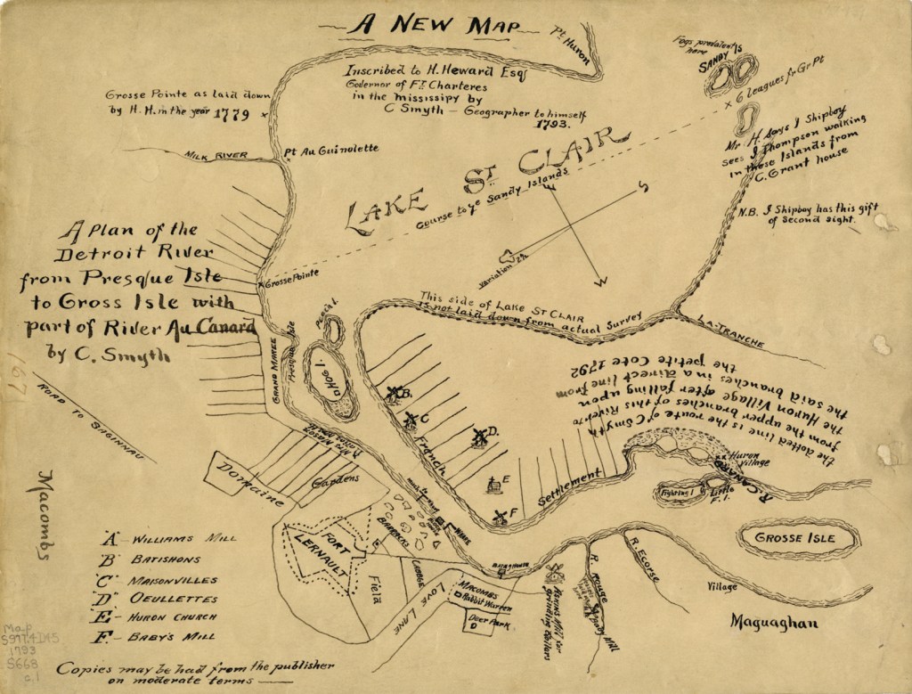
Somehow I’ve never shared this hand drawn beauty of a map from the DPL Digital Collections. The note on the map reads:
“A new map inscribed to H. Heward Esq., Governor of Ft. Charteres in the Mississipy by C. Smyth, geographer to himself, 1793. A plan of the Detroit River from Presque Isle to Gross Isle [sic] with part of River au Canard by C. Smyth.”
Fort Lernault is the most prominent Detroit point of interest. Hog Island and the Grand Marais (spelled Grand Maree on the map) are accompanied by the long “gardens” that we know well as ribbon farms of settler Detroit. In what is Southwest Detroit today there is an interesting assortment of places including: Macomb’s rabbit warren, deer park, and Askins Mill and Baby Mill.o

Thanks! This will be fun.