Do you take the McGraw-Harper expressway? Perhaps the Grand River or Woodward expressway?
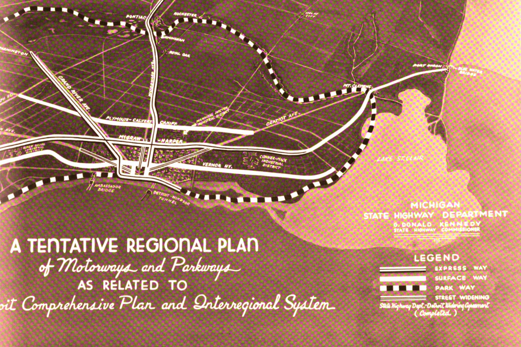
This map is the cover image of a short report that appears to be written for the public. The case is made that expressway development is critical in the goal of slum clearance. From the report:
“It is to be noted that in the highly developed urban areas, the motorways are routed in locations of lowest land values. These are sections in which are found sub-standard housing conditions and evidences of deterioration. This policy effects right-of-way economies and is an essential step in slum clearance.”

Thanks for this link. It looks like a DTR for cars!
Pingback: Map: Extent of Blight in Detroit 1962 | DETROITography
Note that in 1941, Detroit planners thought so much of Belle Isle that they would have turned it into a parkway.
The highway system we have that caused so much destruction was designed by the same people. It started here.