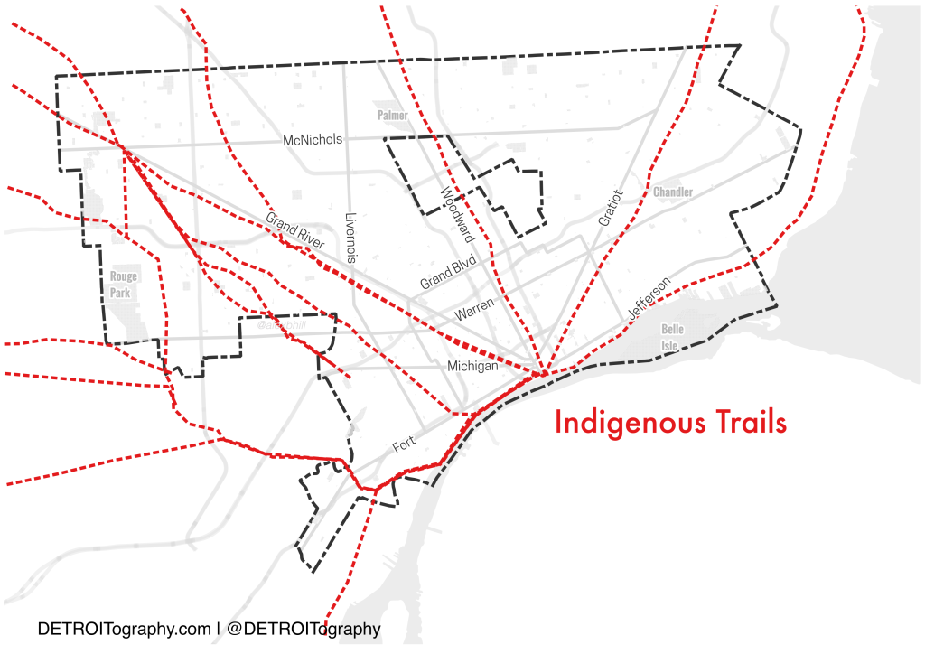
In honor of Indigenous Peoples’ Day, I wanted to share this map that I’ve been thinking about for some time. These trails were digitized and georeferenced from the 1931 Archaeological Atlas of Michigan.
Detroit’s street design with its hub-and-spoke pattern Downtown are often attributed to Western men with grand idea after Detroit’s “Great Fire of 1805.” The story goes that they imagined Detroit in the image of Paris or Washington D.C. – but in reality Detroit’s unique radial streets come from the pathways created by indigenous peoples living on this land before any Frenchman arrived.
