Bill McGraw is a household name if you are interested in city history, street naming, or maps! A veteran of the Detroit Free Press and co-founder of Deadline Detroit, Bill still writes freelance for local publications.
What is your map? (Title, Year, etc.)
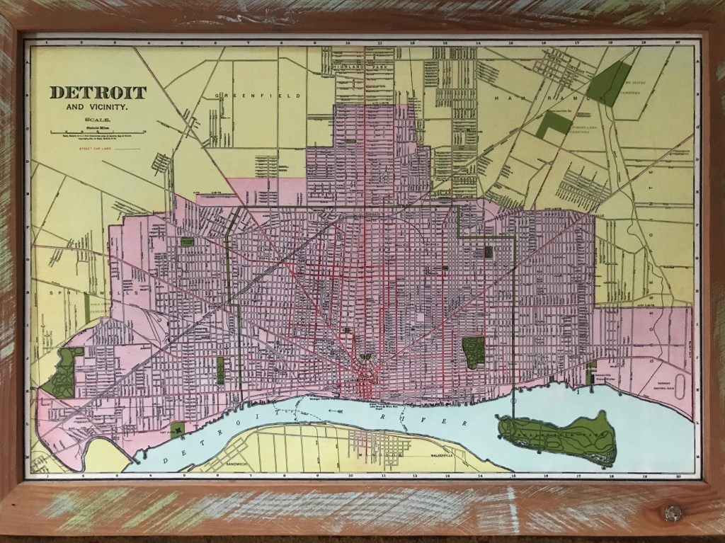
It is a 1911 map of Detroit from Rand McNally Co. from the New Commercial Atlas of America and it’s framed in my living room.
Where did you acquire your map?
I really don’t remember
What made you hang it on your wall? What stood out to you? What details do you enjoy about the map?
It’s pretty and the colors really pop. Detroit is purplish surrounded by yellow with parks in green and roads in red. This was 1911 moving right into the decade where Detroit doubles its population in just 10 years from about 460,000 in 1911 to one million.
It’s interesting because the roads in Grosse Pointe are platted, but not real yet. Leesville is included at Harper and Gratiot and North Detroit is on the map too. I’m fascinated by the street names outside of Detroit. After Detroit annexed them the roads stayed, but the names have changed.
Warren Avenue stops at the city limits at Hurlburt, Mack Avenue goes all the way through, and Connors Creek Road goes all the way from Jefferson up past Mt. Elliott cemetery. The creek isn’t yet covered either. Right at Jefferson and Lenox there is the Detroit Driving Club where in 1901 Henry Ford raced his car and started to get attention.

What in your background has drawn you to maps?
Well, in 2007 I drove the entire city for the “Driving Detroit” series. My Dad worked for Detroit Edison and used the drive around the city everyday. He worked at the little Detroit Edison stores around the city that offered free light bulbs, fridges, and things. We lived on the Eastside and you could give him a location and he would immediately know the major cross streets.
While my Dad was working for Detroit Edison they brought in a Greek guy named Doxiadis who created an extensive plan for the metro region and told Detroit Edison what they wanted to hear with population only growing in the region. My Dad used to bring home all those documents and maps in big tubes and as a kid I got hooked.
