Project Green Light has become something more than imagined. More from America Under Watch:
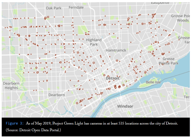
“Detroit’s real-time face surveillance is designed to operate together with a program called Project Green Light Detroit, an initiative launched in January 2016 that has dramatically expanded the city’s network of surveillance cameras. The city has pitched the initiative as a way to deter crime and improve police response times to incidents at locales across the city. Its original focus was on businesses open during late-night hours such as gas stations, fast food restaurants, and liquor stores. Partner locations now also include churches, hotels, clinics, addiction treatment centers, affordable housing apartments, and schools.”

Pingback: Map: Detroit Protests 2020 | DETROITography