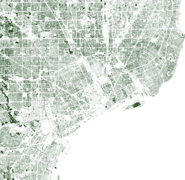
Descartes Labs led by Tim Wallace, formerly of NYT Graphics, is mapping all the city trees. They note that many large cities pay huge sums of money for tree surveys, but those hardly capture all the trees and typically only count street trees. Machine learning with satellite imagery takes care of this so that you can see all the trees and their densities. Obviously, this is not new either, but the machine learning bit automates the process to be quicker than traditional tree canopy analyses.
It looks like Palmer Park has the most dense tree canopy in the city, followed by Belle Isle.
More from Descartes Labs:
Much fuss has been made over city trees in recent years. Urban trees reduce crime and help stormwater management (yay!). Cities and towns across the U.S. are losing 36 million trees a year (boo!). But, hold up—climate change is accelerating the growth of urban trees in metropolises worldwide (boo/yay?). Urban trees are under such scrutiny right now that the U.N. even had a World Forum on Urban Forests a few weeks ago to discuss the planning, design and management of urban forests and green infrastructure.
