
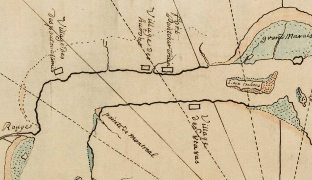
This map was shared by MSU Map Library from the American Indian Historic Collection. It provides a rare glimpse of the “Grand Marais” French for Great Marsh across from Belle Isle. Detroit at this point is simply Fort Pontchartrain next to the soon to be displaced Native American Huron encampment.

Pingback: Map: de Lery’s Copy of de Boishebert’s Map of Detroit 1731 | DETROITography