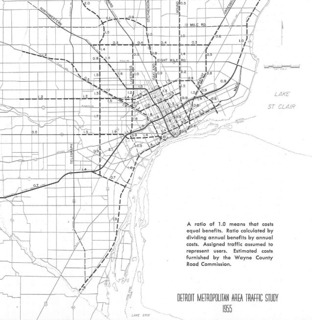
This map is included in Part 2 of the Detroit Metropolitan Area Traffic Study of 1955 by the Michigan State Highway Department. You can see I-94 and the M-10 Lodge Freeway were already complete, but considerations were being made to expand and add more highways. On page 118, it notes:
“Yet there are considerations of land costs; of property removal; of financial responsibility; of classes of trips with relatively greater need; and of public acceptance and rapidity of possible building.”
Not enough weight was given to the consideration of racially disproportionate impacts and wholesale destruction of Detroit’s Black community center where I-75 now lies.
Interestingly the highway proposed along Jefferson Avenue has ratios of 2.3 for every segment making it the highest benefit cost ratio on the map, yet was a highway that was never built. The outcome of that can be seen in the 1968 map of “Where communters run over Black children on the Pointes-Downtown track.” What if that highway had been built?
