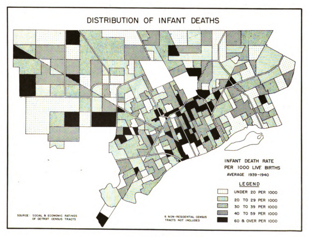
Infant mortality has been a primary health focus area for a very long time in Detroit and across the country as it is an important marker for the overall health of a place. This map from the Detroit City Plan Commission’s report titled: “The People of Detroit.” The legend creates even categories for the data, but you can still see a higher concentration in the city’s central core near Downtown within the ring of Grand Boulevard.
