
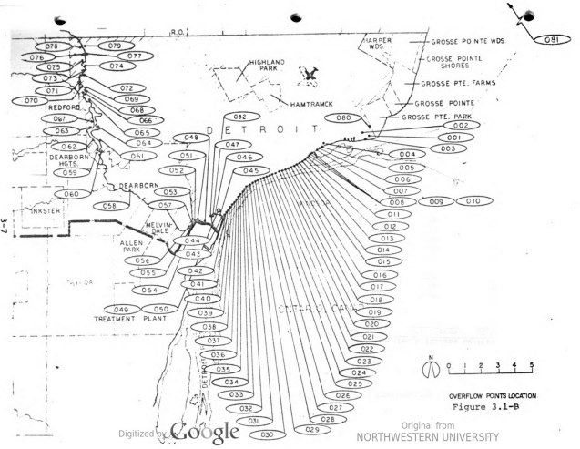
This map was generated to aid in future sewer pollution control planning from the report “Detroit water pollution control system segmented facilities: environmental impact statement.”
I just thought the map design was a bit wild when there are so many opportunities along the Detroit River for pollution overflow on the way to the waste treatment plant.
