Artesian, not to be confused with the wave “artisanal” foods and other products these days, refers to the geology of accessing underground water sources. From USGS:
Groundwater in aquifers between layers of poorly permeable rock, such as clay or shale, may be confined under pressure. If such a confined aquifer is tapped by a well, water will rise above the top of the aquifer and may even flow from the well onto the land surface. Water confined in this way is said to be under artesian pressure, and the aquifer is called an artesian aquifer. The word artesian comes from the town of Artois in France, the old Roman city of Artesium, where the best known flowing artesian wells were drilled in the Middle Ages. The level to which water will rise in tightly cased wells in artesian aquifers is called the potentiometric surface.
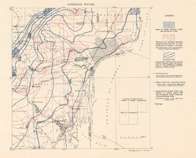
This map is included in the 1917 “Detroit folio, Wayne, Detroit, Grosse Pointe, Romulus, and Wyandotte quadrangles, Michigan” with geological analysis by W. H. Sherzer. It is interesting to see that Springwells was historically an area where flowing wells were “known to occur.”
