
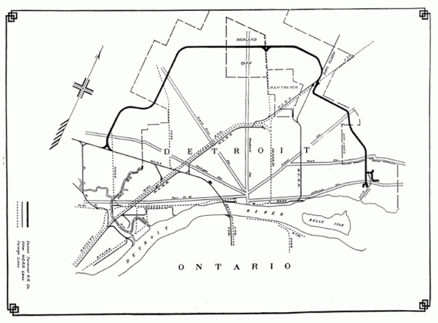
This map is from the New York Central Railroad Annual Report in 1916.
Detroit, like many major cities, had terminal (belt line) railroads to accommodate business. The Detroit Terminal Railroad (DTRR) was started in 1905 by local business owners in order to allow for expansion and access to rail. At the time (1905) all the good business locations were taken up along the major railroads. The construction of the railroad allowed for the continued expansion of industry into more “rural” areas.
Michigan Central Railroad, Grant Trunk, and Lake Shore & Michigan Southern Railway jointed purchased the DTRR after it was built. By 1914, the DTRR needed to add a second track to be able to handle the high level of industrial activity. The Chalmers Motor Company, Hudson Motor Company, Continential Motor Company, and the Ford Motor Company were the main industries on the rail line. Ford’s Highland Park plant was the largest user shipping out 100 freight cars with new automobiles every day.
The DTRR switched ownership many times and was operated by Conrail until 1981. Many of the vacant industrial areas of Detroit today would not have existed without the DTRR. Now the majority of the DTRR is being envisioned as an extension greenway loop that connects with the Dequindre Cut.

I’ve always found it interesting that you can map Detroit’s industrial districts by where the RRs went. Look at a zoning map today, and those heavy industrial districts will almost always been near a RR track. Very cool map.
Another Detroit website. That’s excellent. The more the better, because I find Detroit fascinating.
Pingback: Highland Park Part II: The Road to Cityhood [ Detroit Urbanism ] – The Laborious Truth