Inspired by Nathan Yau’s work at FlowingData on pizza place geography and grocery store geography, I wanted to see how Detroit’s ubiquitous locations compared. Driving along Van Dyke where there was church after church (many abandoned) interspersed with liquor stores gave me the idea of examining which type of location dominated Detroit’s landscape.
 It takes forever to scrape the Michigan Liquor Control Commission (MLCC) website for active liquor licenses, so I relied on a 2012 dataset that I generated a while back. I then utilized data from Data Driven Detroit with Churches from 2011. The data is not perfect, but unless you have someone actively monitoring every liquor license and every church there is going to be significant change. Notably, the number of liquor licenses have been decreasing since 2009. The next step was to set up a grid that was generally half a square mile squares.
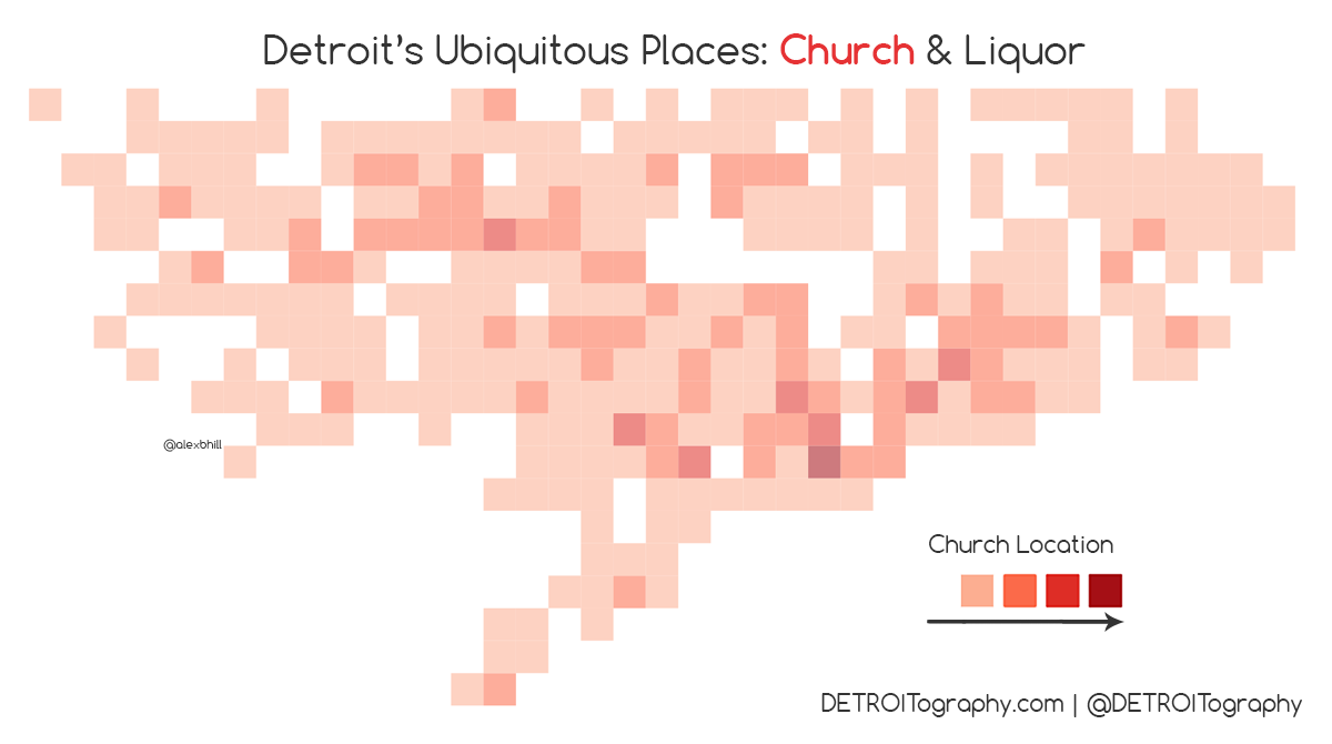 There are a lot of churches in Detroit and they come in all shapes and sizes from mega churches that cover an entire block to converted storefront churches and the smattering of beautiful historic churches large and small.
 There is a strong concentration of liquor licenses Downtown, which isn’t surprising with the density of restaurants and bars. However there are other notable areas that dot the city with a high number of liquor licenses.
 The result of overlaying this data is interesting in that there appears to be a sort of “church belt” that stretches from Downtown to Northwest while liquor stores dominate the areas in between. Churches are more spread out across Detroit and liquor stores tend to be located closer together. It is safe to say that Detroit residents likely live closer to a church than a liquor store, but depending on where you live there may be a near equal amount of each type of location.

Reblogged this on Alex B. Hill.