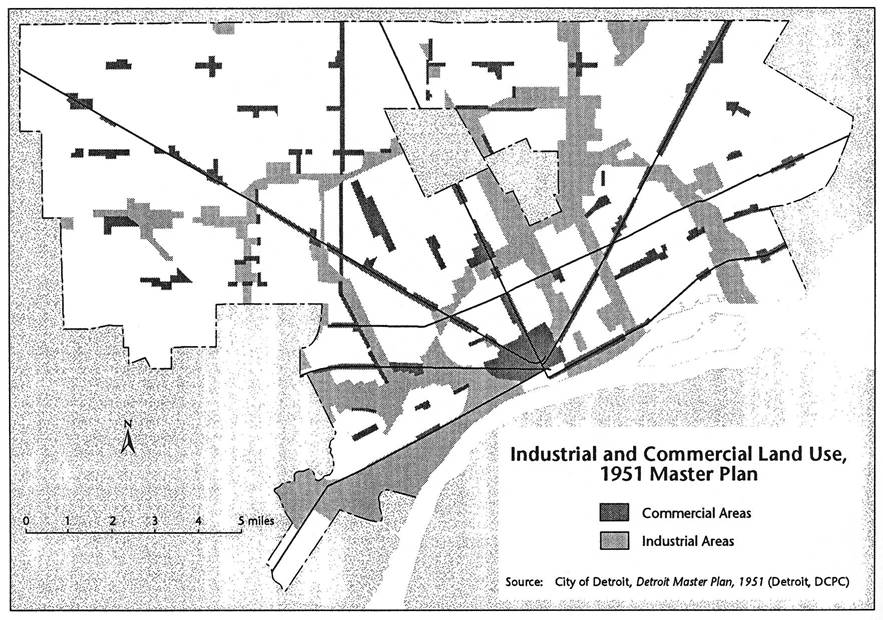
 This Master Plan map from 1951 is focused on land use. The 1950 Census puts Detroit population at its peak of 1,849,568 people.
The most significant element that can be seen is this map is the extent of “industrial” land use. Much of the 1951 industrial areas in Southwest and along the I-75 corridor are no longer. Similarly, the “commercial” areas have shrunk considerably, especially Downtown and many of the neighborhood commercial areas.

Pingback: Did Michigan violate civil rights law with its permit to US Ecology? | DETOUR
The Master Plan is for proposed land use, possibly not what the land was being used for in 1951.
The southwest I-75 corridor referred to was not that industrialized. The map refers to the proposed expansion of industrial usage and the elimination of residential areas in Southwest, Corktown and, Delray.