Map: Detroit Annexation 1891

det-annex-1891

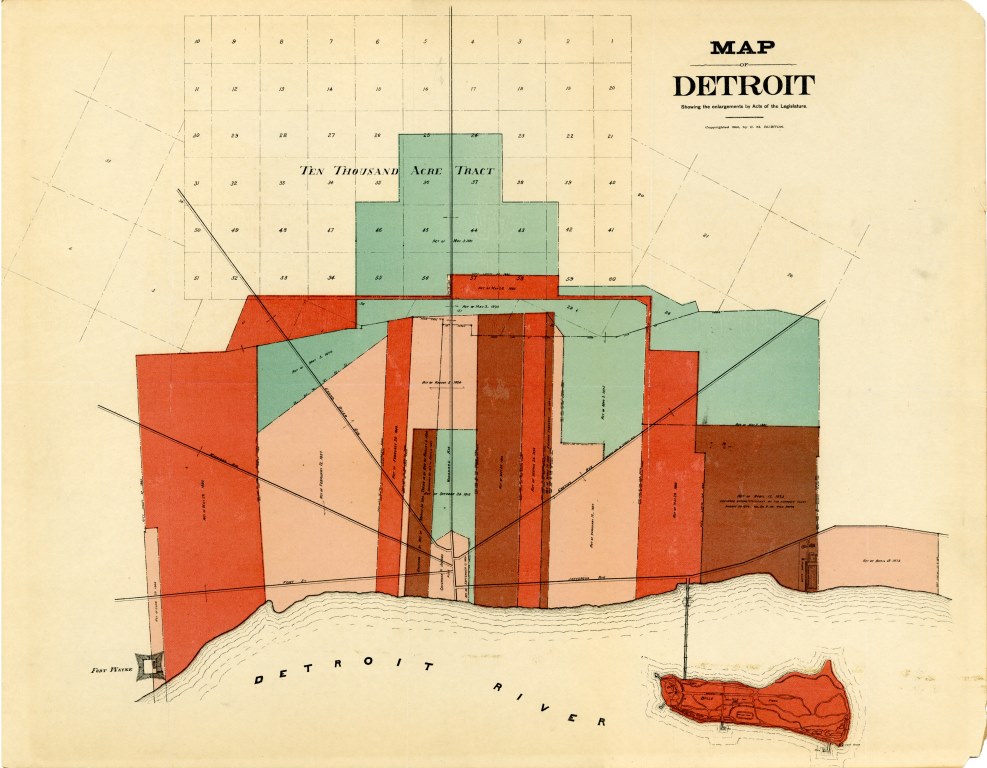
From the Detroit Historical Society:

“This 1891 map shows us how the boundaries of Detroit expanded through Acts of Legislature starting in 1806. It even notes when an enlargement was declared unconstitutional by the Supreme Court.”

You can see the evolution of land surveying and street grid developments too!

Leave a Reply

Fill in your details below or click an icon to log in:

WordPress.com Logo

You are commenting using your WordPress.com account. Log Out /  Change )

Facebook photo

You are commenting using your Facebook account. Log Out /  Change )

Connecting to %s