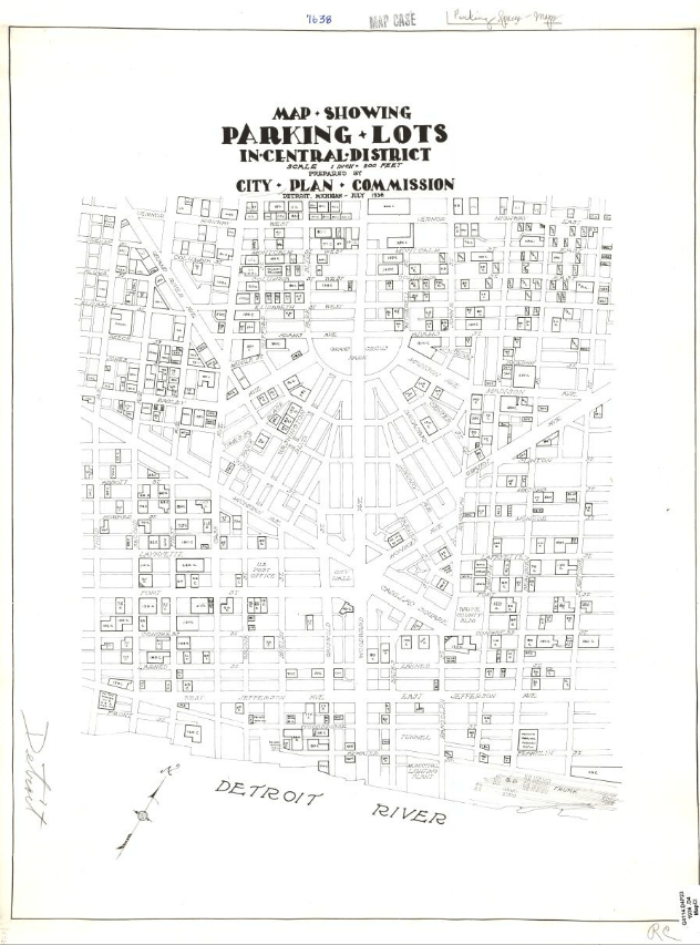
This incredible historical gem comes from the University of Chicago Library Map Collection of Planning Maps of Midwestern Cities in the 1920s and 1930s. This map from the Detroit Plan Commission provides an early glimpse at the focus on car culture in Detroit. Not to mention the map appears to be hand drawn including the typography.

Pingback: Map: The Growth of Parking Lots in Downtown Detroit | DETROITography
Pingback: Theater of the Every-day (Olivia Howard) – Contested Spaces