
The City of Detroit has a clear walkability problem outside of certain zones, like Midtown, Corktown, Hamtramck, or pockets in Northwest Detroit.
More from the project:
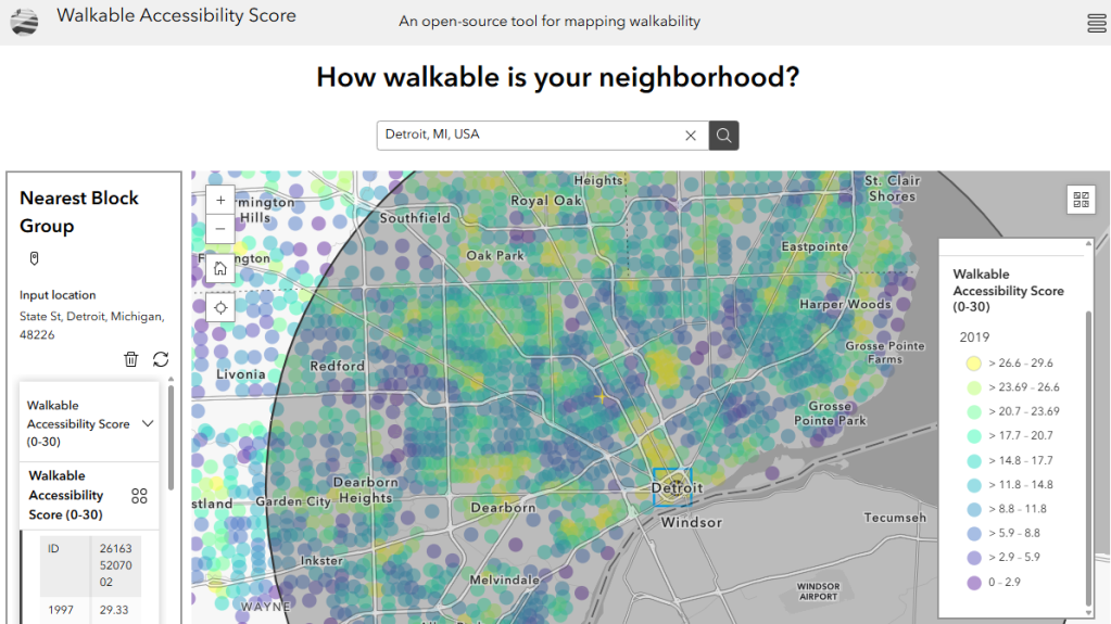
… the Walkable Accessibility Score measures the average accessibility to nearby urban amenities from neighbourhood centers. To create the WAS, we first calculate the distance from every block group centroid (shown on the map above) to the nearest 30 grocery stores, pharmacies, retail shops, banks, bookstores, schools, parks, hotels, restaurants, cafes, and bakeries. Then, the distance to each of these amenities is weighted by how far away it is from the block group centroid, up to a maximum distance of around 1600m. A block group with 30 amenities all located within a very short distance of its center (e.g., 400m) recieves a full value of ’30’ for the WAS. Using POI data, we are able to calculate the WAS for every block group in the continental US for every year from 1997-2019. For more detail, see the full paper here.
