
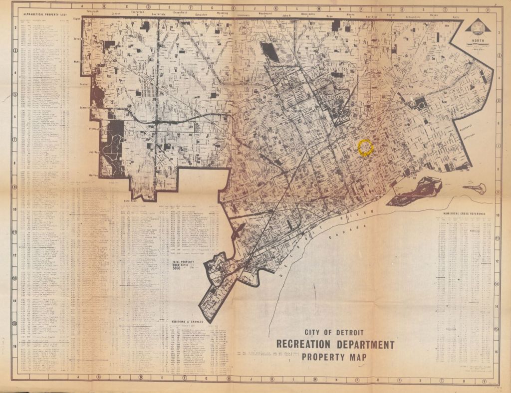
I can’t remember where I found this map, but I’m glad that I did. The map is huge and could only be scanned using the large format, flat-bed scanner at the Reuther Library. This map is printed on this heavy paper, thick to the touch almost like a stiff fabric.
The map has some weathering and discoloration, but was clearly a map in active use from at least 1972 to 1976. What I love most about it is the active crossing out of property locations, like the “Seward 12th Playlot” and the active “Additions & Changes” including name changes, like “Seward-12th Playlot.” The map total the acres for the recreation Department at 5850 as of 1/72 (January 1972) and 5860 as of 1/76 (January 1976). There is a mystery highlighted circle at Mt. Elliott north of Gratiot. What was the Recreation Department planning in 1976?
This map is part of the Hill Map Collection digitized in partnership with the Reuther Library and Archives as part of the Detroit Atlas Collaboration funded in part by the WSU Union of Part Time Faculty (UPTF) Professional Development Fund.
