
by: Kelsey Maas, Wayne State University (Intro to GIS, Fall 2024)
Public libraries have long served the people of Detroit. The first public library opened in 1865 in the Old
Capitol building. Due to extensive population growth, the City constructed its first library branches to
meet need. Eventually, eight more branches were created from funds from the American Industrialist
Andrew Carnegie with the last Carnegie branch approved by the City Council in 1917. More branches continued to be built to serve the growing city well into the twentieth century. Eventually, the appearance of new branches ceased as the population shrank in the mid-twentieth century.
More recently, public and community resources (library branches, public schools, etc) have reduced due
to the loss of Detroit residents and disinvestment. As Detroit is geographically large (143 mi), this
means residents must travel further to access public amenities. Additionally, limited public
transportation options and frequency, further adds to access issues. This project aims to examine who
can walk to Detroit Public Libraries and who is left out through a spatial lens. The boundaries are the
City of Detroit’s borders. It will highlight the neighborhoods served and underserved by Detroit Public
Libraries.
The concept of the 15 Minute City helps to frame walkability. The term was coined by urbanist Carlos
Moreno and remains a popular framework for evaluating the livability of cities. The 15 Minute City is an
ideal urban environment that is structured at a human scale where residents can get to their everyday
needs within a 15 minute walkable or cyclable travel radius. Community benefits from a 15 Minute City
design consist of socioeconomic equity (residents are not limited if they do not have a car), less vehicle
dependence (reduces carbon emissions), increased walking and biking (better health), and increased
standards of living (conveniently located services).
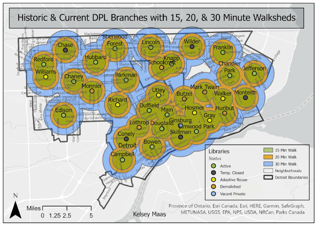
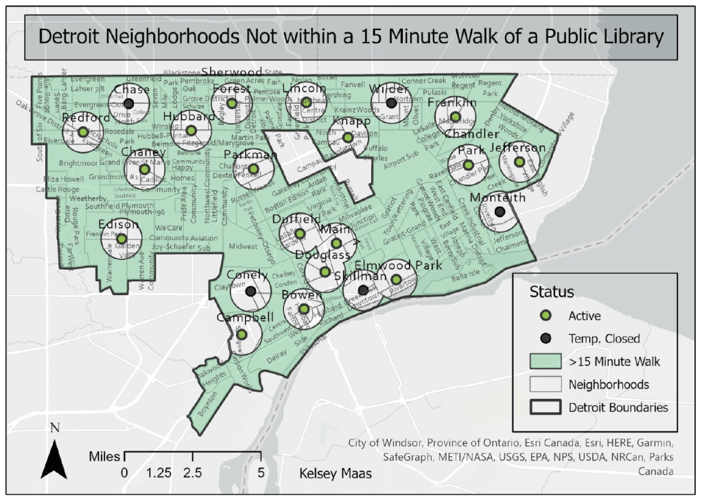
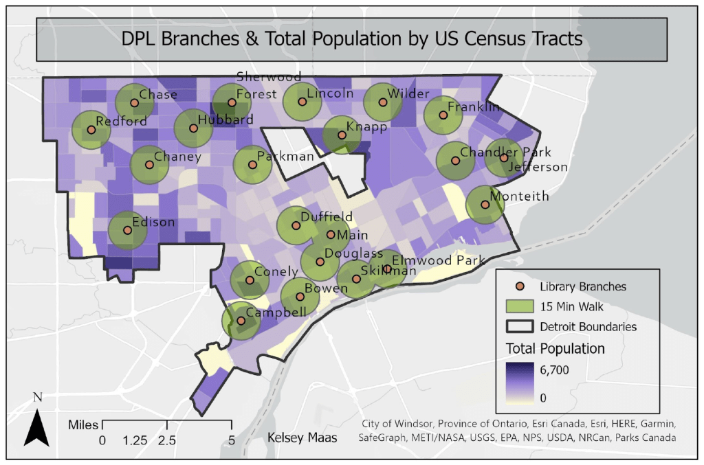
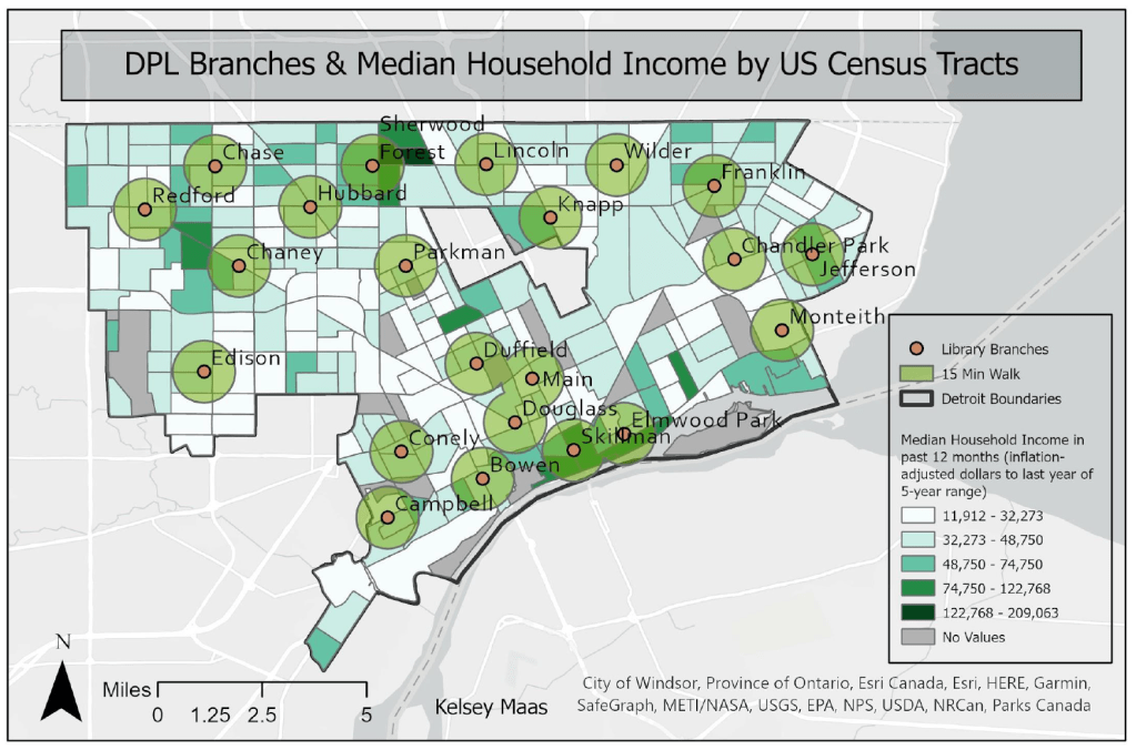
The Detroit Public Library system currently has 22 physical locations. Of these branches, five are
temporarily closed. The first set of maps illustrates which Detroit neighborhoods are serviced within a
15 minute (0.75 mile), 20 minute (1 mile), and 30 minute (1.5 mile) walk of a library branch. The map’s buffer distance was calculated per the 15 Minute City framework and methodology.
The maps include both the active and temporarily closed branches with the understanding that the five temporarily closed branches will reopen in the coming years.
