
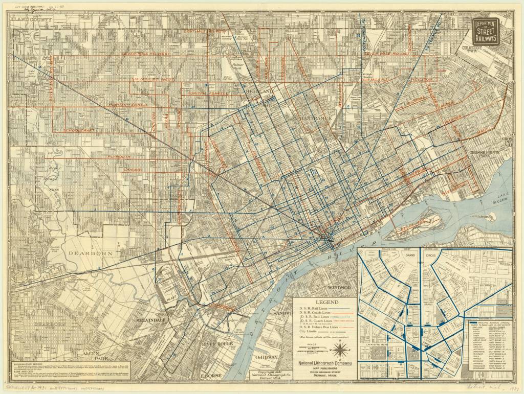
This 1931 Detroit Street Railways transportation map from the digital collections at the American Geographical Society Library, University of Wisconsin-Milwaukee Libraries is a beauty.
Can we bring back the bus route through the center of Belle Isle?
I’ve been cataloging maps in various archives and collections to get a comprehensive picture of Detroit’s cartographic history. In the Fall, efforts will be going full force to georeference as many maps as we can to analyze the city through history.
Check this map out on AllMaps, a platform to georeference any map from any institution that supports IIIF.
