
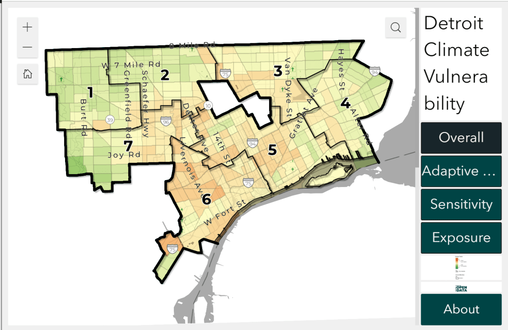
This map is part of the City of Detroit Climate Strategy informed by the Climate Equity Advisory Council. The goal of this map is to visualize climate vulnerability factors at the census tract scale. From the site:
Mapping climate vulnerability is important because the impacts of heat, flooding, and air quality are not felt equally across the city. Some areas and populations are more likely to be harmed by climate hazards than others, and visualizing what areas are most impacted can help in decision-making.
