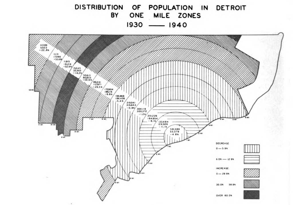
Here described as “one mile zones” this display of population change in Detroit is, I think, the most unique I’ve ever seen.
This map is included in a digest of “proposals for downtown Detroit” for the Urban Land Institute (ULI) from 1942.

Here described as “one mile zones” this display of population change in Detroit is, I think, the most unique I’ve ever seen.
This map is included in a digest of “proposals for downtown Detroit” for the Urban Land Institute (ULI) from 1942.
