
by: Josh Lohrke
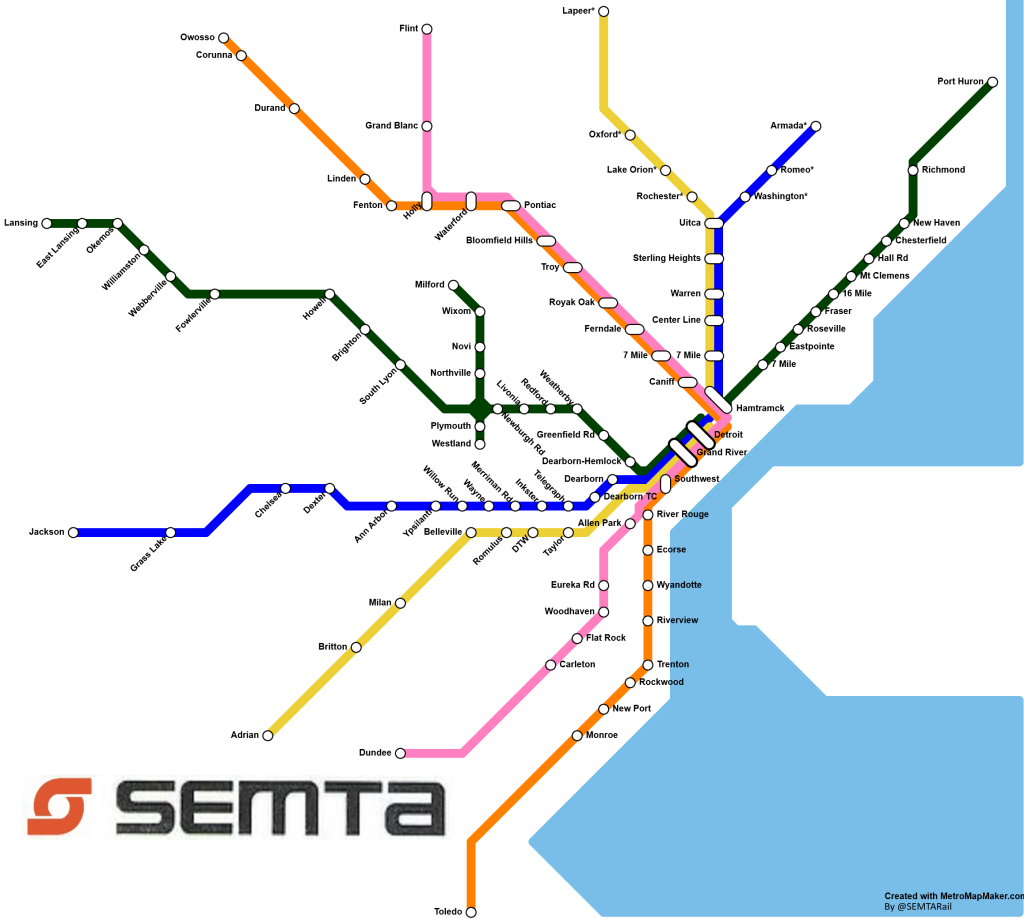
I made this is fantasy transit map for Metro Detroit with a few goals in mind. My first step was to create a map that would both revolutionize transit in Metro Detroit while also being as realistic as possible given our state and region’s lack of investment and what current right-of-ways exist. This map is an attempt at a compromise between fantasy and realism. It also tries to challenge the idea that Detroit is too decentralized to have good regional transit by showing that a good system can be achieved by going through the heart of Detroit.
This map imagines the birth of the SEMTA Regional Rail, a callback to Detroit’s last regional rail service, the SEMTA commuter rail, which ran peak direction trains between Pontiac and a station outside the Renaissance Center. With the SEMTA Regional Rail above there were a couple goals. First and most notably, this map is based on existing infrastructure. Except for the stations marked with an asterisk (*), of which there are 7, in track alone these lines currently exist. Some of that track is either too old, disused, or single track and thus low capacity. But the fact that the right of way and much of the track for this project currently exists means that relative to other regional rail projects or ideas this project would be cheap to build.
This map also emphasizes cross region trips with large transfer stations in the city. This map attempts to answer the problem that Detroit is “too spread out” for regional transit. All the lines are on average as direct as they can be, and they all go through the heart of the city. While it may be faster to drive from each end of a line to the other, this directness makes the train competitive, especially when there is traffic or routes without a freeway. I also have noticed that many Detroit regional rail fantasy maps have trains dead ending in the city which in the modern era is more and more of an outdated use pattern. This map tries to emphasize regional trips while maintaining the same focus on Detroit.
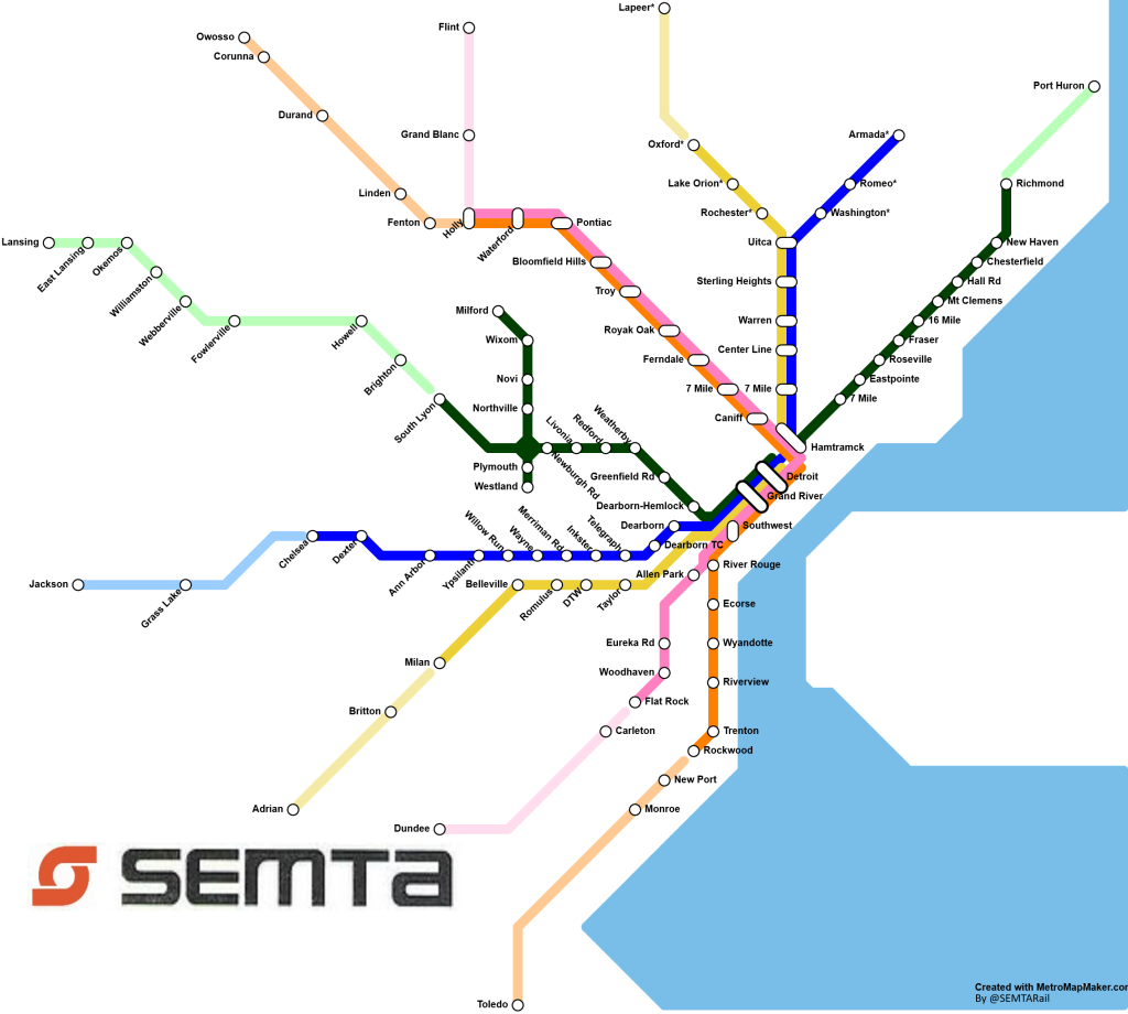
The above version of the SEMTA map shows the same system but the lines are lighter when the system leaves RTA territory. RTA is the current 4-county regional transit authority, and if we wanted to fund this system without state help this is what that system would likely look like. The big thing this version of the map lacks is larger anchor cities on the ends of lines that would likely be drivers of ridership.
My hope with this post is to help people dream of a modern transit system for Detroit that would both serve the region well and feel realistic to dream about. I believe the system I have mapped is a realistic system to dream of given our region’s stubbornness with building regional transit. Future improvements could be:
- Tunneling under downtown to move the transfer stations down from New Center
- Expanding the Green Line branch to be its own line going from Flint to Monroe
- Adding an Ann Arbor to Howell connection
- Including a connection to Windsor

Thank you for the maps of a possible regional rail system centered upon Detroit. I appreciate your continued efforts to promote such a system. Detroit is making a remarkable come back from its woes. A regional rail transit system would stimulate further redevelopment.